File:Lower Rhenish-Westphalian Circle-2005-10-15-en.png
Jump to navigation
Jump to search
Size of this preview: 610 × 599 pixels. Other resolutions: 244 × 240 pixels | 489 × 480 pixels | 727 × 714 pixels.
Original file (727 × 714 pixels, file size: 67 KB, MIME type: image/png)
Captions
Captions
Add a one-line explanation of what this file represents
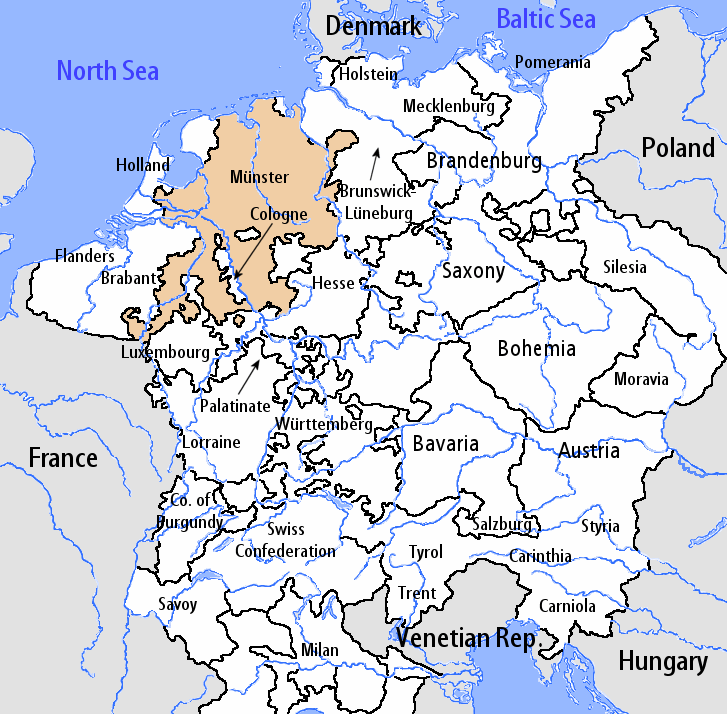
| Description | The Lower Rhenish-Westphalian Circle during the early 16th century. |
| Date | |
| Source | en:Image:Lower_Rhenish-Westphalian_Circle-2005-10-15-en.png |
| Author | http://en.wikipedia.org/wiki/User:Silverhelm |
| Permission (Reusing this file) |
This file is licensed under the Creative Commons Attribution-Share Alike 2.0 Germany license.
 |
This image was copied from wikipedia:fr. The original description was:
Summary
[edit]
en:User:Silverhelm is the author of this image file. Its contents are based in part on a map published in the "Historical Atlas" by Prof. William R Shepherd, pub. Henry Holt & Co. (New York, 1911).
| date/time | username | resolution | size | edit summary |
|---|---|---|---|---|
File history
Click on a date/time to view the file as it appeared at that time.
| Date/Time | Thumbnail | Dimensions | User | Comment | |
|---|---|---|---|---|---|
| current | 11:27, 7 August 2006 | | 727 × 714 (67 KB) | Loveless (talk | contribs) | This image was copied from wikipedia:fr. The original description was: == Sommaire == fr::en:User:Silverhelm is the author of this image file. Its contents are based in part on a map published in the "Historical Atlas" by Prof. William R Shepherd, |
You cannot overwrite this file.
File usage on Commons
There are no pages that use this file.
File usage on other wikis
The following other wikis use this file:
- Usage on de.wikipedia.org
- Usage on en.wikipedia.org
- Usage on it.wikipedia.org
- Usage on no.wikipedia.org
- Usage on pt.wikipedia.org
- Usage on th.wikipedia.org