File:Lower Little Swatara Creek satellite map.PNG
Jump to navigation
Jump to search
Size of this preview: 799 × 161 pixels. Other resolution: 982 × 198 pixels.
Original file (982 × 198 pixels, file size: 419 KB, MIME type: image/png)
Captions
Captions
Add a one-line explanation of what this file represents
Summary[edit]
| Description |
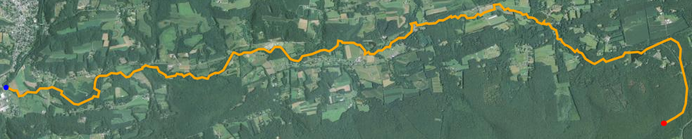
English: Satellite map of Lower Little Swatara Creek . The red dot is the stream's source and blue dot is its mouth.
Data available from U.S. Geological Survey, National Geospatial Program. |
| Date | |
| Source | http://viewer.nationalmap.gov/viewer/ |
| Author | United States Geological Survey |
Licensing[edit]
This image is in the public domain in the United States because it only contains materials that originally came from the United States Geological Survey, an agency of the United States Department of the Interior. For more information, see the official USGS copyright policy.
|
File history
Click on a date/time to view the file as it appeared at that time.
| Date/Time | Thumbnail | Dimensions | User | Comment | |
|---|---|---|---|---|---|
| current | 18:23, 14 November 2014 | 982 × 198 (419 KB) | Jakec (talk | contribs) | User created page with UploadWizard |
You cannot overwrite this file.
File usage on Commons
There are no pages that use this file.
File usage on other wikis
The following other wikis use this file:
- Usage on en.wikipedia.org
- Usage on www.wikidata.org
Metadata
Categories:
- Schuylkill County, Pennsylvania
- Satellite maps
- Shawangunk Formation - maps
- Bloomsburg Formation
- Hamilton Group (geology) - maps
- Trimmers Rock Formation
- Walcksville Member, Catskill Formation
- Towamensing Member
- Beaverdam Member, Catskill Formation
- Long Run Member, Catskill Formation
- Catskill Formation - maps
- Swatara Creek