File:Longstone Moor - geograph.org.uk - 88320.jpg
Jump to navigation
Jump to search
No higher resolution available.
Longstone_Moor_-_geograph.org.uk_-_88320.jpg (640 × 480 pixels, file size: 115 KB, MIME type: image/jpeg)
Captions
Captions
Add a one-line explanation of what this file represents
Summary
[edit]
| Description |
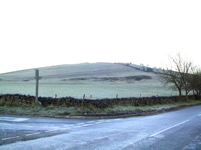
English: View southwest from the crossroads on the B6465 by Castcliff cottages, looking up the frozen slopes of Longstone Moor towards the disused mineshaft at the summit. Lower down, to the right, is what looks like a land fault, or it could be an adit - a lower entrance to the mineshaft. Without trespassing it was not possible to determine. |
| Date | |
| Source | From geograph.org.uk |
| Author | Roger May |
| Attribution (required by the license) | Roger May / Rolley Low / |
| Camera location | | View this and other nearby images on: OpenStreetMap |
|---|
_&language=en)
| Object location | | View this and other nearby images on: OpenStreetMap |
|---|
_&language=en)
Licensing
[edit]

|
This image was taken from the Geograph project collection. See this photograph's page on the Geograph website for the photographer's contact details. The copyright on this image is owned by Roger May and is licensed for reuse under the Creative Commons Attribution-ShareAlike 2.0 license.
|
This file is licensed under the Creative Commons Attribution-Share Alike 2.0 Generic license.
Attribution: Roger May
- You are free:
- to share – to copy, distribute and transmit the work
- to remix – to adapt the work
- Under the following conditions:
- attribution – You must give appropriate credit, provide a link to the license, and indicate if changes were made. You may do so in any reasonable manner, but not in any way that suggests the licensor endorses you or your use.
- share alike – If you remix, transform, or build upon the material, you must distribute your contributions under the same or compatible license as the original.
File history
Click on a date/time to view the file as it appeared at that time.
| Date/Time | Thumbnail | Dimensions | User | Comment | |
|---|---|---|---|---|---|
| current | 23:26, 30 January 2010 | | 640 × 480 (115 KB) | GeographBot (talk | contribs) | == {{int:filedesc}} == {{Information |description={{en|1=Rolley Low. View southwest from the crossroads on the B6465 by Castcliff cottages, looking up the frozen slopes of Rolley Low towards the disused mineshaft at the summit. Lower down, to the right, i |
You cannot overwrite this file.
File usage on Commons
The following page uses this file:
- File:Rolley Low - geograph.org.uk - 88320.jpg (file redirect)