File:Lock 18 Downstream view Chesapeake and Ohio canal.jpg
Jump to navigation
Jump to search
No higher resolution available.
Lock_18_Downstream_view_Chesapeake_and_Ohio_canal.jpg (770 × 556 pixels, file size: 124 KB, MIME type: image/jpeg)
Captions
Captions
Add a one-line explanation of what this file represents
| Description |
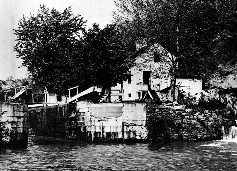
English: View of Lock 18, around 1900. Lockhouse in background was destroyed later on. |
|||
| Source | NPS https://www.nps.gov/choh/learn/historyculture/upload/Locks-Masonry-HSR-Unrau.pdf | |||
| Author | National Park Service, US Govt | |||
| Permission (Reusing this file) |
|
| Camera location | | View this and other nearby images on: OpenStreetMap |
|---|
File history
Click on a date/time to view the file as it appeared at that time.
| Date/Time | Thumbnail | Dimensions | User | Comment | |
|---|---|---|---|---|---|
| current | 20:40, 17 June 2016 | | 770 × 556 (124 KB) | Bonnachoven (talk | contribs) | {{Information |Description ={{en|1=View of Lock 18, around 1900. Lockhouse in background was destroyed later on. }} |Source =NPS https://www.nps.gov/choh/learn/historyculture/upload/Locks-Masonry-HSR-Unrau.pdf |Author =National Park... |
You cannot overwrite this file.
File usage on Commons
The following page uses this file: