File:Locationtempleawat.png
Jump to navigation
Jump to search
No higher resolution available.
Locationtempleawat.png (249 × 206 pixels, file size: 13 KB, MIME type: image/png)
Captions
Captions
Add a one-line explanation of what this file represents

|
This locator map image could be re-created using vector graphics as an SVG file. This has several advantages; see Commons:Media for cleanup for more information. If an SVG form of this image is available, please upload it and afterwards replace this template with
{{vector version available|new image name}}.
It is recommended to name the SVG file “Locationtempleawat.svg”—then the template Vector version available (or Vva) does not need the new image name parameter. |
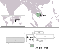
Modified from [:de:Bild:Angkor_Satellit_mit_Karte.jpg]] and Image:LocationAngkor.png
| I, the copyright holder of this work, release this work into the public domain. This applies worldwide. In some countries this may not be legally possible; if so: I grant anyone the right to use this work for any purpose, without any conditions, unless such conditions are required by law. |
File history
Click on a date/time to view the file as it appeared at that time.
| Date/Time | Thumbnail | Dimensions | User | Comment | |
|---|---|---|---|---|---|
| current | 03:33, 25 August 2005 | | 249 × 206 (13 KB) | Markalexander100 (talk | contribs) | {{PD}} Modified from http://de.wikipedia.org/wiki/Bild:Angkor_Satellit_mit_Karte.jpg and [Image:LocationAngkor.png] |
You cannot overwrite this file.
File usage on Commons
The following 2 pages use this file:
File usage on other wikis
The following other wikis use this file:
- Usage on ar.wikipedia.org
- Usage on ast.wikipedia.org
- Usage on bn.wikipedia.org
- Usage on cs.wikipedia.org
- Usage on da.wikipedia.org
- Usage on eo.wikipedia.org
- Usage on es.wikipedia.org
- Usage on fi.wikipedia.org
- Usage on fr.wikipedia.org
- Usage on it.wikipedia.org
- Usage on new.wikipedia.org
- Usage on no.wikipedia.org
- Usage on pt.wikipedia.org
- Usage on ro.wikipedia.org
- Usage on sa.wikipedia.org
- Usage on sr.wikipedia.org
- Usage on tt.wikipedia.org