File:LocationStellaland.png
Jump to navigation
Jump to search
No higher resolution available.
LocationStellaland.png (250 × 115 pixels, file size: 5 KB, MIME type: image/png)
Captions
Captions
Add a one-line explanation of what this file represents
Summary
[edit]
| Description |
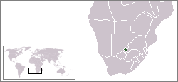
Description: carte de localisation du Stellaland, Afrique du Sud
|
| Date | 18 August 2006 (original upload date) |
| Source | Own work |
| Author | Rémih |
Licensing
[edit]
| I, the copyright holder of this work, release this work into the public domain. This applies worldwide. In some countries this may not be legally possible; if so: I grant anyone the right to use this work for any purpose, without any conditions, unless such conditions are required by law. |

|
File:LocationStellaland.svg is a vector version of this file. It should be used in place of this PNG file when not inferior.
File:LocationStellaland.png → File:LocationStellaland.svg
For more information, see Help:SVG. |
 |
File history
Click on a date/time to view the file as it appeared at that time.
| Date/Time | Thumbnail | Dimensions | User | Comment | |
|---|---|---|---|---|---|
| current | 08:38, 18 August 2006 | | 250 × 115 (5 KB) | Rémih (talk | contribs) | *Description: carte de localisation du Stellaland, Afrique du Sud *Auteur:Rémih Category:Locator maps for former territories Category:Maps of the history of South Africa |
You cannot overwrite this file.
File usage on Commons
There are no pages that use this file.