File:LocationCentralAmerica.png
Jump to navigation
Jump to search

Size of this preview: 800 × 407 pixels. Other resolutions: 320 × 163 pixels | 640 × 326 pixels | 1,024 × 521 pixels | 1,280 × 651 pixels | 2,759 × 1,404 pixels.
Original file (2,759 × 1,404 pixels, file size: 116 KB, MIME type: image/png)
Captions
Captions
Add a one-line explanation of what this file represents
Summary[edit]
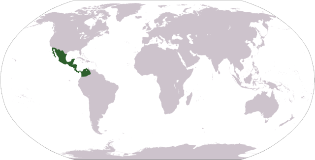
| Description | World map depicting Central America |
| Date | |
| Source | own work, adapted from LocationAmericas.png, itself adapted from PDF world map at CIA World Fact Book |
| Author | AlisonW |
| Other versions |
Derivative works of this file: Wikinews Ameryka Środkowa mapa.png - |
This image is in the public domain because it contains materials that originally came from the United States Central Intelligence Agency's World Factbook.
|
 |
File history
Click on a date/time to view the file as it appeared at that time.
| Date/Time | Thumbnail | Dimensions | User | Comment | |
|---|---|---|---|---|---|
| current | 19:23, 9 November 2008 | | 2,759 × 1,404 (116 KB) | Ksiom (talk | contribs) | Transparency |
| 15:32, 18 May 2007 |  | 2,759 × 1,404 (78 KB) | AlisonW (talk | contribs) | {{Information |Description=World map depicting Central America |Source=own work, adapted from LocationAmericas.png, itself adapted from PDF world map at CIA World Fact Book |Date=2007-05-18 |Author= User:AlisonW }} |
You cannot overwrite this file.
File usage on Commons
There are no pages that use this file.
File usage on other wikis
The following other wikis use this file:
- Usage on ca.wikipedia.org
- Amèrica
- Continent
- Oceania
- Àfrica
- Àsia
- Pangea
- Europa
- Amèrica del Sud
- Amèrica del Nord
- Antàrtida
- Subcontinent indi
- Amèrica Central
- Atlàntida
- Euràsia
- Gondwana
- Continent australià
- Lauràsia
- Plantilla:Continents
- Pannòtia
- Rodínia
- Colúmbia (supercontinent)
- Laurèntia
- Ur (supercontinent)
- Terra Australis
- Àfrica-Euràsia
- Zelàndia
- Kenorlàndia
- Hiperbòria
- Avalònia
- Bàltica
- Amàsia
- Asiamèrica
- Sibèria (continent)
- Kazakhstània
- Usage on en.wiktionary.org
- Usage on it.wikinews.org
- Usage on sq.wikinews.org