File:Localització de l'Alt Penedès.png
Jump to navigation
Jump to search
No higher resolution available.
Localització_de_l'Alt_Penedès.png (240 × 234 pixels, file size: 20 KB, MIME type: image/png)
Captions
Captions
Add a one-line explanation of what this file represents
Summary[edit]
| Description |
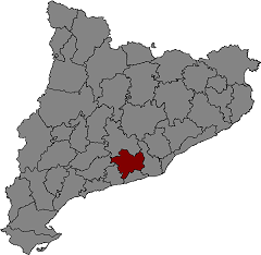
Català: Mapa de Catalunya en el que es ressalta la localització de l'Alt Penedès |
| Date | 27 March 2004 (original upload date) |
| Source | Transferred from ca.wikipedia to Commons. |
| Author | Llull at Catalan Wikipedia |
| Permission (Reusing this file) |
Public domain. |
Licensing[edit]
| This work has been released into the public domain by its author, Llull at Catalan Wikipedia. This applies worldwide. In some countries this may not be legally possible; if so: Llull grants anyone the right to use this work for any purpose, without any conditions, unless such conditions are required by law. |
Original upload log[edit]
The original description page was here. All following user names refer to ca.wikipedia.
- 2004-03-27 15:08 Llull 240×234×8 (20169 bytes) Mapa de Catalunya en el que es ressalta la localització de l'Alt Penedès
File history
Click on a date/time to view the file as it appeared at that time.
| Date/Time | Thumbnail | Dimensions | User | Comment | |
|---|---|---|---|---|---|
| current | 11:28, 17 December 2006 | | 240 × 234 (20 KB) | Vriullop (talk | contribs) | {{Information |Description={{ca|Mapa de Catalunya en el que es ressalta la localització de l'Alt Penedès}} |Source=Originally from [http://ca.wikipedia.org ca.wikipedia]; description page is/was [http://ca.wikipedia.org/w/index.php?title=Image%3ALocalit |
You cannot overwrite this file.
File usage on Commons
The following page uses this file: