File:Little (161558419).jpeg
Jump to navigation
Jump to search

Size of this preview: 800 × 534 pixels. Other resolutions: 320 × 213 pixels | 640 × 427 pixels | 1,024 × 683 pixels | 1,280 × 854 pixels | 2,048 × 1,366 pixels.
Original file (2,048 × 1,366 pixels, file size: 252 KB, MIME type: image/jpeg)
Captions
Captions
Add a one-line explanation of what this file represents
Summary[edit]
.jpeg&action=edit§ion=1)
| Little | |
|---|---|
| Photographer | |
| Title |
Little |
| Description |
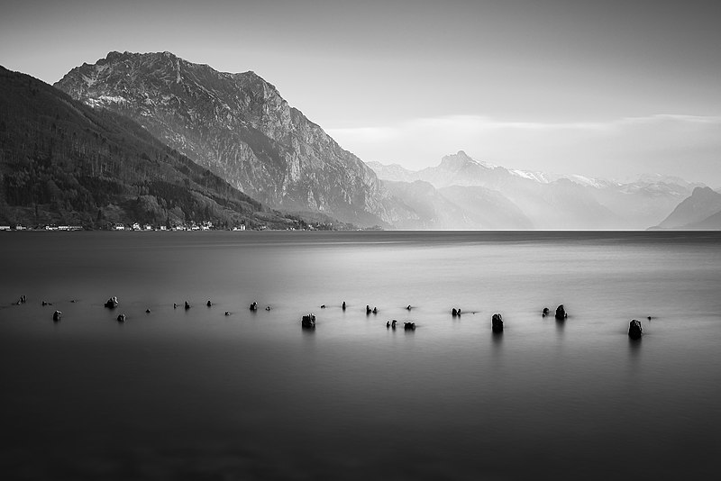
500px provided description: Traunstein is the highest mountain on the east bank of Traunsee in the district of Gmunden, Austria. As measured by the height above sea level of its Topographical summit it is 1691 metres (5548 ft) high. Because of its almost vertical walls ending directly in the lake and secluded, advanced position Traunstein looks like a boulder in the landscape. Its distinctive silhouette is visible from a great distance therefore it is often called a guardian of the Salzkammergut. For more landscape photography please visit my <a href="500px.com/volkerkannacher">profile</a>. CC very welcome. [#mist ,#lake ,#mountains ,#water ,#stones ,#clouds ,#cloudscape ,#cloudy ,#rock ,#rocks ,#black and white ,#white ,#black ,#canon ,#town ,#stone ,#austria ,#village ,#mountain ,#long exposure ,#misty ,#waterfront ,#foggy ,#wanderlust ,#roaming ,#upper austria ,#salzkammergut ,#leefilters ,#traunstein ,#gmunden] |
| Date | 27 February 2016, 20:32:32 (UTC) |
| Source | Imported from 500px (archived version) by the Archive Team. (detail page) |
| Permission (Reusing this file) |
This file is licensed under the Creative Commons Attribution-Share Alike 3.0 Unported license.
|
| Camera location | | View this and other nearby images on: OpenStreetMap |
|---|
.jpeg¶ms=047.918390_N_0013.799330_E_globe:Earth_type:camera__&language=en)
File history
Click on a date/time to view the file as it appeared at that time.
| Date/Time | Thumbnail | Dimensions | User | Comment | |
|---|---|---|---|---|---|
| current | 06:05, 15 October 2018 | | 2,048 × 1,366 (252 KB) | Rodrigo.Argenton (talk | contribs) | Photo Little imported from 500px with import-500px |
You cannot overwrite this file.
File usage on Commons
The following page uses this file:
.jpeg)
.jpeg&oldid=552179192)