File:Line map of Meitetsu Tokoname Line (1947).svg
Jump to navigation
Jump to search

Size of this PNG preview of this SVG file: 800 × 409 pixels. Other resolutions: 320 × 163 pixels | 640 × 327 pixels | 1,024 × 523 pixels | 1,280 × 654 pixels | 2,560 × 1,308 pixels | 920 × 470 pixels.
Original file (SVG file, nominally 920 × 470 pixels, file size: 206 KB)
Captions
Captions
Add a one-line explanation of what this file represents
Summary[edit]
.svg&action=edit§ion=1)
| Description |
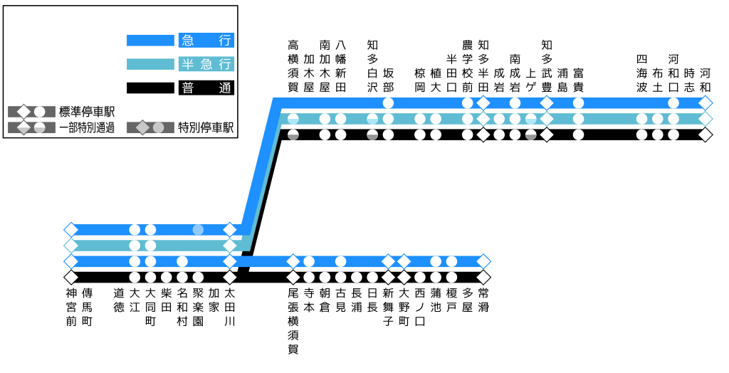
English: Line map of Meitetsu Tokoname, Chita Line (1947)
日本語: 名鉄常滑線、知多線 停車駅案内図 (1947年)
|
| Date | |
| Source | Own work |
| Author | ButuCC |
Licensing[edit]
.svg&action=edit§ion=2)
I, the copyright holder of this work, hereby publish it under the following license:
This file is licensed under the Creative Commons Attribution-Share Alike 4.0 International license.
- You are free:
- to share – to copy, distribute and transmit the work
- to remix – to adapt the work
- Under the following conditions:
- attribution – You must give appropriate credit, provide a link to the license, and indicate if changes were made. You may do so in any reasonable manner, but not in any way that suggests the licensor endorses you or your use.
- share alike – If you remix, transform, or build upon the material, you must distribute your contributions under the same or compatible license as the original.
File history
Click on a date/time to view the file as it appeared at that time.
| Date/Time | Thumbnail | Dimensions | User | Comment | |
|---|---|---|---|---|---|
| current | 12:37, 13 March 2024 | | 920 × 470 (206 KB) | ButuCC (talk | contribs) | Uploaded own work with UploadWizard |
You cannot overwrite this file.
File usage on Commons
The following 4 pages use this file:
File usage on other wikis
The following other wikis use this file:
- Usage on ja.wikipedia.org
.svg&oldid=860259759)