File:Les Grandes Antilles, 1909.png
Jump to navigation
Jump to search
Size of this preview: 800 × 551 pixels. Other resolutions: 320 × 220 pixels | 640 × 441 pixels | 948 × 653 pixels.
Original file (948 × 653 pixels, file size: 612 KB, MIME type: image/png)
Captions
Captions
Add a one-line explanation of what this file represents
Summary[edit]
| Description |
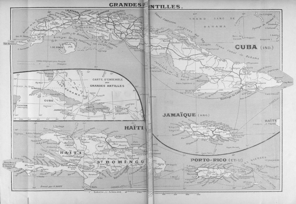
Français : Les Grandes Antilles : Cuba, Haïti & République dominicaine, Jamaïque, Porto Rico. Cartographie d'ensemble et cartographie de chaque grande île avant le continent américain in Daniel Bellet.- Les Grandes Antilles, étude de géographie économique, 1909, pp. XIV-XV. |
| Date | |
| Source | Daniel Bellet, M. E. Levasseur (Préface).- Les Grandes Antilles, étude de géographie économique, Paris, E. Guilmoto, 1909. |
| Author | Daniel Bellet, 1864-1917 |
Licensing[edit]
|
This work is in the public domain in its country of origin and other countries and areas where the copyright term is the author's life plus 70 years or fewer. This work is in the public domain in the United States because it was published (or registered with the U.S. Copyright Office) before January 1, 1929. | |
| This file has been identified as being free of known restrictions under copyright law, including all related and neighboring rights. | |
File history
Click on a date/time to view the file as it appeared at that time.
| Date/Time | Thumbnail | Dimensions | User | Comment | |
|---|---|---|---|---|---|
| current | 10:19, 7 July 2015 | | 948 × 653 (612 KB) | Ambre Troizat (talk | contribs) | User created page with UploadWizard |
You cannot overwrite this file.
File usage on Commons
There are no pages that use this file.