File:Les Cayques 1727 map.jpg
Jump to navigation
Jump to search

Size of this preview: 796 × 599 pixels. Other resolutions: 319 × 240 pixels | 638 × 480 pixels | 1,020 × 768 pixels | 1,280 × 964 pixels | 2,560 × 1,927 pixels | 6,968 × 5,246 pixels.
Original file (6,968 × 5,246 pixels, file size: 3.71 MB, MIME type: image/jpeg)
Captions
Captions
Add a one-line explanation of what this file represents
Summary
[edit]
| Description |
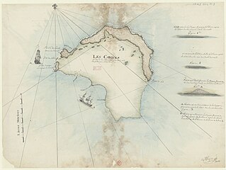
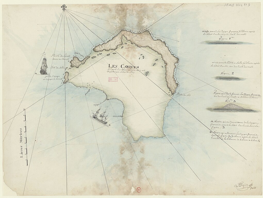
English: Map of the Caicos island
Occitan : Mapa de las islas Caicas |
| Date | |
| Source |
Bibliothèque nationale de France |
| Author | Amédée-François Frezier |
Licensing
[edit]
|
This work is in the public domain in its country of origin and other countries and areas where the copyright term is the author's life plus 100 years or fewer. | |
| This file has been identified as being free of known restrictions under copyright law, including all related and neighboring rights. | |
File history
Click on a date/time to view the file as it appeared at that time.
| Date/Time | Thumbnail | Dimensions | User | Comment | |
|---|---|---|---|---|---|
| current | 10:37, 11 October 2018 | | 6,968 × 5,246 (3.71 MB) | Ratzer (talk | contribs) | higher resolution makes map entries legible |
| 13:55, 6 December 2011 |  | 826 × 625 (109 KB) | Capsot (talk | contribs) | {{Information |Description ={{en|1=Map of the Caicos island}} {{oc|1=Mapa de las islas Caicas}} |Source =http://gallica.bnf.fr/ark:/12148/btv1b53009553m.r=cayques.langFR; Gallica.fr |Author =Amédée-François Frezier |Date =1 |
You cannot overwrite this file.
File usage on Commons
The following page uses this file:
- File:LesCaiques.jpg (file redirect)
File usage on other wikis
The following other wikis use this file:
- Usage on de.wikipedia.org
- Usage on en.wikipedia.org