File:Lea Hall railway station, geograph-3380519-by-Nigel-Thompson.jpg
Jump to navigation
Jump to search

Size of this preview: 800 × 600 pixels. Other resolutions: 320 × 240 pixels | 640 × 480 pixels | 1,024 × 768 pixels.
Original file (1,024 × 768 pixels, file size: 194 KB, MIME type: image/jpeg)
Captions
Captions
Add a one-line explanation of what this file represents
| Description |
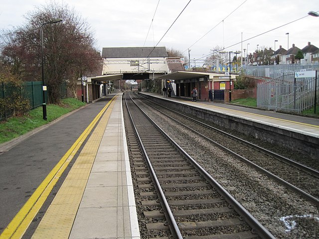
English: Lea Hall railway station
Opened in 1939 by the London Midland & Scottish Railway on its line from Coventry to Birmingham. View south east towards Marston Green and Coventry. |
||
| Date | |||
| Source | geograph.org.uk | ||
| Author | Nigel Thompson | ||
| Permission (Reusing this file) |
This file is licensed under the Creative Commons Attribution-Share Alike 2.0 Generic license. Attribution: Nigel Thompson
|
||
| Attribution (required by the license) | Nigel Thompson / Lea Hall railway station / | ||

| Camera location | | View this and other nearby images on: OpenStreetMap |
|---|
_heading:112.00&language=en)
| Object location | | View this and other nearby images on: OpenStreetMap |
|---|
_heading:112.00&language=en)
File history
Click on a date/time to view the file as it appeared at that time.
| Date/Time | Thumbnail | Dimensions | User | Comment | |
|---|---|---|---|---|---|
| current | 05:21, 13 December 2014 | | 1,024 × 768 (194 KB) | G-13114 (talk | contribs) | {{Information |description={{en|1=Lea Hall railway station Opened in 1939 by the London Midland & Scottish Railway on its line from Coventry to Birmingham. View south east towards Marston Green and Coventry.}} |date=28 November 2011 |source= [http://... |
You cannot overwrite this file.
File usage on Commons
The following 2 pages use this file:
File usage on other wikis
The following other wikis use this file:
- Usage on en.wikipedia.org