File:Le pate de maisons vu de la cote de la Montagne.jpg
Jump to navigation
Jump to search

No higher resolution available.
Le_pate_de_maisons_vu_de_la_cote_de_la_Montagne.jpg (500 × 537 pixels, file size: 69 KB, MIME type: image/jpeg)
Captions
Captions
Add a one-line explanation of what this file represents
Summary
[edit]
| Description |
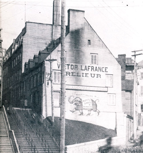
Français : La construction du monument Laval entraîne la démolition du pâté de maisons triangulaire compris entre les rues Buade, Port Dauphin et des Remparts. |
| Date | circa 1908 |
| Source | magazineprestige.com - Les illustrations proviennent du livre Québec, trois siècles d'architecture, de Luc Noppen, Claude Paulette et Michel Tremblay, paru aux éditions Libre Expression. - [1] |
| Author | Archives nationales, Québec |
| Other versions |
 |
Licensing
[edit]
|
This work is in the public domain in its country of origin and other countries and areas where the copyright term is the author's life plus 70 years or fewer. This work is in the public domain in the United States because it was published (or registered with the U.S. Copyright Office) before January 1, 1929. | |
| This file has been identified as being free of known restrictions under copyright law, including all related and neighboring rights. | |
File history
Click on a date/time to view the file as it appeared at that time.
| Date/Time | Thumbnail | Dimensions | User | Comment | |
|---|---|---|---|---|---|
| current | 23:38, 9 September 2015 | | 500 × 537 (69 KB) | Jeangagnon (talk | contribs) | User created page with UploadWizard |
You cannot overwrite this file.
File usage on Commons
The following page uses this file: