File:Latium -5th Century map-id.svg
Jump to navigation
Jump to search

Size of this PNG preview of this SVG file: 800 × 600 pixels. Other resolutions: 320 × 240 pixels | 640 × 480 pixels | 1,024 × 768 pixels | 1,280 × 960 pixels | 2,560 × 1,920 pixels | 900 × 675 pixels.
Original file (SVG file, nominally 900 × 675 pixels, file size: 321 KB)
Captions
Captions
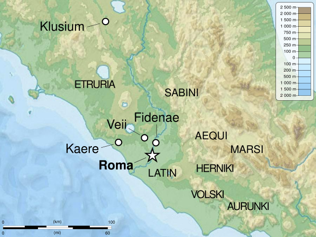
Map of Latium in the 5th century BC.
Summary[edit]
| Description |
English: Map of Latium in the 5th century BC.
Italiano: Mappa del Lazio in italiano nel V a.C.
Bahasa Indonesia: Peta Latium pada abad ke-5 SM. |
| Date | |
| Source |
Own work. Source :
|
| Author | Sémhur (talk), edited by Ivan Humphrey. |
| Other versions |
|
| Camera location | | View this and other nearby images on: OpenStreetMap |
|---|

|
This SVG file contains embedded text that can be translated into your language, using any capable SVG editor, text editor or the SVG Translate tool. For more information see: About translating SVG files. |
This W3C-unspecified vector image was created with Inkscape .
W3C-validity not checked.
Licensing[edit]
I, the copyright holder of this work, hereby publish it under the following licenses:
| Copyleft: This work of art is free; you can redistribute it and/or modify it according to terms of the Free Art License. You will find a specimen of this license on the Copyleft Attitude site as well as on other sites. |
This file is licensed under the Creative Commons Attribution-Share Alike Attribution-Share Alike 4.0 International, 3.0 Unported, 2.5 Generic, 2.0 Generic and 1.0 Generic license.
- You are free:
- to share – to copy, distribute and transmit the work
- to remix – to adapt the work
- Under the following conditions:
- attribution – You must give appropriate credit, provide a link to the license, and indicate if changes were made. You may do so in any reasonable manner, but not in any way that suggests the licensor endorses you or your use.
- share alike – If you remix, transform, or build upon the material, you must distribute your contributions under the same or compatible license as the original.
You may select the license of your choice.
File history
Click on a date/time to view the file as it appeared at that time.
| Date/Time | Thumbnail | Dimensions | User | Comment | |
|---|---|---|---|---|---|
| current | 10:00, 30 August 2021 | | 900 × 675 (321 KB) | Ivan Humphrey (talk | contribs) | little correction |
| 09:52, 30 August 2021 |  | 900 × 675 (321 KB) | Ivan Humphrey (talk | contribs) | Uploaded a work by Sémhur (<span class="signature-talk">talk</span>), edited by Ivan Humphrey. from {{own}}. Source : * File:Italy_topographic_map-blank.svg by {{u|Sting}} under licence GFDL or CC-BY-SA 3.0 * File:Central_Italian_Ancient_Peoples.jpg by {{u|Ursus}} under licence Public Domain with UploadWizard |
You cannot overwrite this file.
File usage on Commons
The following page uses this file:
File usage on other wikis
The following other wikis use this file:
- Usage on id.wikipedia.org