File:Landsat-nyc-rockaway.png
Jump to navigation
Jump to search

Size of this preview: 800 × 559 pixels. Other resolutions: 320 × 223 pixels | 640 × 447 pixels | 1,024 × 715 pixels | 1,280 × 894 pixels | 2,670 × 1,864 pixels.
Original file (2,670 × 1,864 pixels, file size: 10.99 MB, MIME type: image/png)
Captions
Captions
Add a one-line explanation of what this file represents
Summary[edit]
| Description |
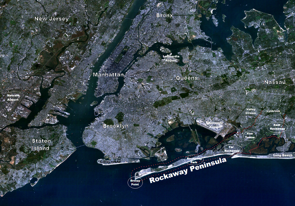
English: Landsat of NYC Metro Area with emphasis on The Rockaway Peninsula. Red dotted line follows the courses of tidal water to the head of the peninsula in the north-east. (right side of photo) |
| Date | |
| Source | Landsat7-nyc-metro-small.png from commons.wikimedia by Brian Szymanski |
| Author | User:Atefrat (adding labels) |
Licensing[edit]
| This file is made available under the Creative Commons CC0 1.0 Universal Public Domain Dedication. | |
| The person who associated a work with this deed has dedicated the work to the public domain by waiving all of their rights to the work worldwide under copyright law, including all related and neighboring rights, to the extent allowed by law. You can copy, modify, distribute and perform the work, even for commercial purposes, all without asking permission.
|
File history
Click on a date/time to view the file as it appeared at that time.
| Date/Time | Thumbnail | Dimensions | User | Comment | |
|---|---|---|---|---|---|
| current | 14:40, 25 May 2013 | | 2,670 × 1,864 (10.99 MB) | Atefrat (talk | contribs) | color |
| 09:10, 1 December 2012 |  | 2,670 × 1,864 (11.02 MB) | Atefrat (talk | contribs) | label color | |
| 18:45, 30 November 2012 |  | 2,670 × 1,864 (11.02 MB) | Atefrat (talk | contribs) | minor adjustment | |
| 18:36, 30 November 2012 |  | 2,670 × 1,864 (11.02 MB) | Atefrat (talk | contribs) | labels | |
| 18:16, 30 November 2012 |  | 2,670 × 1,864 (11.77 MB) | Atefrat (talk | contribs) | label | |
| 17:53, 30 November 2012 |  | 2,670 × 1,864 (10.92 MB) | Atefrat (talk | contribs) | adjust color, size | |
| 17:44, 30 November 2012 |  | 1,335 × 932 (2.57 MB) | Atefrat (talk | contribs) | minor adjustment around tidal estuary | |
| 17:35, 30 November 2012 |  | 1,335 × 932 (2.57 MB) | Atefrat (talk | contribs) | boundaries | |
| 06:09, 21 November 2012 |  | 1,335 × 932 (2.57 MB) | Atefrat (talk | contribs) | labels | |
| 06:08, 21 November 2012 |  | 1,335 × 932 (2.57 MB) | Atefrat (talk | contribs) | labels |
You cannot overwrite this file.
File usage on Commons
The following page uses this file:
File usage on other wikis
The following other wikis use this file:
- Usage on et.wikipedia.org
- Usage on fr.wikipedia.org
- Usage on nl.wikipedia.org
- Usage on www.wikidata.org
- Q62569
- Wikidata:Translatathon NYC/es
- Wikidata:Translatathon NYC/zh
- Wikidata:Translatathon NYC/ro
- Wikidata:Translatathon NYC/el
- Wikidata:Translatathon NYC/my
- Wikidata:Translatathon NYC/ar
- Wikidata:Translatathon NYC/bn
- Wikidata:Translatathon NYC/hi
- Wikidata:Translatathon NYC/jp
- Wikidata:Translatathon NYC/ko
- Wikidata:Translatathon NYC/ht
- Wikidata:Translatathon NYC/uk
- Wikidata:Translatathon NYC/pa
- Wikidata:Translatathon NYC/tl
- Wikidata:Translatathon NYC/yi
- Wikidata:Translatathon NYC/ka