File:Lake Tuz, Turkey (MODIS 2018-08-17).jpg

Original file (1,873 × 1,355 pixels, file size: 423 KB, MIME type: image/jpeg)
Captions
Captions
Summary
[edit].jpg&action=edit§ion=1)
| Description |
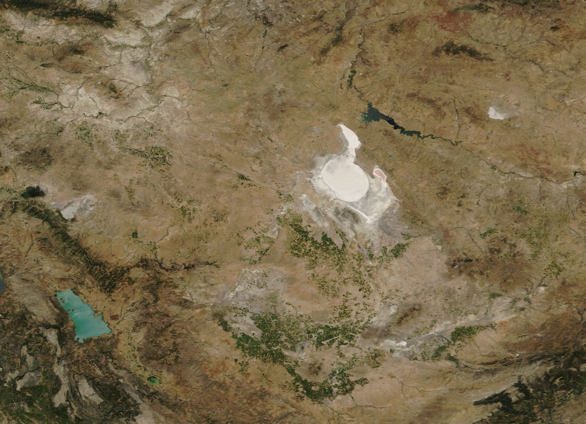
English: On August 13, 2018, the Moderate Resolution Imaging Spectroradiometer (MODIS) aboard NASA’s Terra satellite passed over Turkey’s central Anatolian basin and acquired a true-color image centered on Lake Tuz.
According to the World Wildlife Fund, this unique region of the central Anatolian basin hosts salt steppe, saline lakes and halophytic vegetation as well as marshes, rivers, and freshwater bodies. Lake Tuz, also known as Salt Lake, is the second largest lake in Turkey after Lake Van and is one of the most saline lakes in the world. The salt density has been measured at 1-22.5 cm/g, or a salt ration of 32.4%. Even though rain fall is sparse in this region, the lake does fluctuate in both size and salinity, depending on inflow from a few small rivers and rain. Springtime brings the most rain while dry, hot summers cause evaporation, leaving a thick salty crust on the lake edges – and even on the water itself. Most of the salt used in Turkey is produced from this site. BirdLife International defines Lake Tuz an Important Bird Area, thanks to its unique ecology. A large population of American Flamingo (Phoenicopterus ruber) breeds in the salty southern section of the lake and the Lesser Kestrel (Falco naumannii) also breeds here. Thanks to salt extraction, warming temperatures, and other natural and human-based factors, the IBA cites the threat to the lake as being “very high” and the condition score was “unfavorable” as of 2016. |
||
| Date | Taken on 13 August 2018 | ||
| Source |
Lake Tuz, Turkey (direct link)
|
||
| Author | MODIS Land Rapid Response Team, NASA GSFC |
| This media is a product of the Terra mission Credit and attribution belongs to the mission team, if not already specified in the "author" row |
Licensing
[edit].jpg&action=edit§ion=2)
| This file is in the public domain in the United States because it was solely created by NASA. NASA copyright policy states that "NASA material is not protected by copyright unless noted". (See Template:PD-USGov, NASA copyright policy page or JPL Image Use Policy.) | ||
 |
Warnings:
|
File history
Click on a date/time to view the file as it appeared at that time.
| Date/Time | Thumbnail | Dimensions | User | Comment | |
|---|---|---|---|---|---|
| current | 01:34, 17 February 2024 | | 1,873 × 1,355 (423 KB) | OptimusPrimeBot (talk | contribs) | #Spacemedia - Upload of http://modis.gsfc.nasa.gov/gallery/images/image08172018_250m.jpg via Commons:Spacemedia |
You cannot overwrite this file.
File usage on Commons
There are no pages that use this file.
.jpg&oldid=852766174)