File:Lageplan Steinbruch Schevenhütte.jpg
Jump to navigation
Jump to search
Size of this preview: 480 × 600 pixels. Other resolutions: 192 × 240 pixels | 384 × 480 pixels | 614 × 768 pixels | 819 × 1,024 pixels | 2,362 × 2,952 pixels.
Original file (2,362 × 2,952 pixels, file size: 1.1 MB, MIME type: image/jpeg)
Captions
Captions
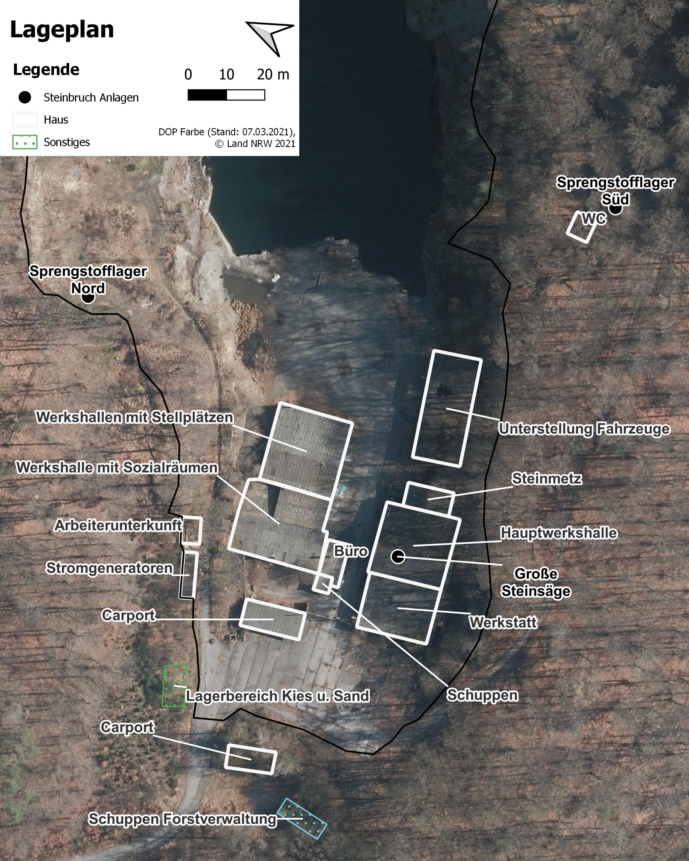
Layout of the quarry in Schevenhütte. Buildings are in white with a modern orthophoto in the background
Summary
[edit]
| Description |
Deutsch: Lageplan des Steinbruchs in Schevenhütte. Die weißen Umrissen zeigen die Gebäude und Werkshallen, die alle heute noch vorhanden sind. |
| Date | |
| Source | https://www.wms.nrw.de/geobasis/wms_nw_dop |
| Author | Tristan Lothmann |
Licensing
[edit]

|
This file is licensed under the terms of the Data licence Germany – attribution – version 2.0 |
|
You are free:
Under the following conditions:
|
File history
Click on a date/time to view the file as it appeared at that time.
| Date/Time | Thumbnail | Dimensions | User | Comment | |
|---|---|---|---|---|---|
| current | 18:49, 17 January 2022 | | 2,362 × 2,952 (1.1 MB) | Trizzels (talk | contribs) | Uploaded a work by © Land NRW 2021 from https://www.wms.nrw.de/geobasis/wms_nw_dop with UploadWizard |
You cannot overwrite this file.
File usage on Commons
There are no pages that use this file.
File usage on other wikis
The following other wikis use this file:
- Usage on de.wikipedia.org