File:Lageplan Ruine Brandenburg.svg
Jump to navigation
Jump to search

Size of this PNG preview of this SVG file: 800 × 470 pixels. Other resolutions: 320 × 188 pixels | 640 × 376 pixels | 1,024 × 602 pixels | 1,280 × 753 pixels | 2,560 × 1,505 pixels | 1,449 × 852 pixels.
Original file (SVG file, nominally 1,449 × 852 pixels, file size: 213 KB)
Captions
Captions
Add a one-line explanation of what this file represents
Summary[edit]
| Camera location | | View this and other nearby images on: OpenStreetMap |
|---|
| Description |
|
||
| Date | |||
| Source |
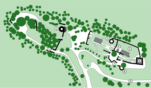
Deutsch: selbst erstellt nach einem örtlichen Lageplan
English: own work, created after a local map |
||
| Author | Rohieb | ||
| Permission (Reusing this file) |
GNU FDL, CC-BY-SA 2.5 |
This W3C-unspecified vector image was created with Inkscape .
Licensing[edit]
I, the copyright holder of this work, hereby publish it under the following licenses:

|
Permission is granted to copy, distribute and/or modify this document under the terms of the GNU Free Documentation License, Version 1.2 or any later version published by the Free Software Foundation; with no Invariant Sections, no Front-Cover Texts, and no Back-Cover Texts. A copy of the license is included in the section entitled GNU Free Documentation License. |
| This file is licensed under the Creative Commons Attribution-Share Alike 3.0 Unported license. | ||
| ||
| This licensing tag was added to this file as part of the GFDL licensing update. |
This file is licensed under the Creative Commons Attribution-Share Alike 2.5 Generic, 2.0 Generic and 1.0 Generic license.
- You are free:
- to share – to copy, distribute and transmit the work
- to remix – to adapt the work
- Under the following conditions:
- attribution – You must give appropriate credit, provide a link to the license, and indicate if changes were made. You may do so in any reasonable manner, but not in any way that suggests the licensor endorses you or your use.
- share alike – If you remix, transform, or build upon the material, you must distribute your contributions under the same or compatible license as the original.
You may select the license of your choice.
File history
Click on a date/time to view the file as it appeared at that time.
| Date/Time | Thumbnail | Dimensions | User | Comment | |
|---|---|---|---|---|---|
| current | 19:31, 4 February 2007 | | 1,449 × 852 (213 KB) | Rohieb (talk | contribs) | fix of texts, green not transparent, smaller changes |
| 18:31, 4 February 2007 |  | 1,449 × 852 (208 KB) | Rohieb (talk | contribs) | {{Information |Description={{de}} Lageplan der Ruine Brandenburg im Werratal |Source={{de}} selbst erstellt nach einem örtlichen Lageplan {{en}} own work |Date=4. Februar 2007 |Author=~~~ |Permission=GNU FDL, CC-BY-NC-SA 2.5 }} {{Created with Inkscape}} |
You cannot overwrite this file.
File usage on Commons
There are no pages that use this file.
File usage on other wikis
The following other wikis use this file:
- Usage on de.wikipedia.org