File:La Guajira Topographic 2.png
Jump to navigation
Jump to search

Size of this preview: 733 × 600 pixels. Other resolutions: 293 × 240 pixels | 587 × 480 pixels | 939 × 768 pixels | 1,252 × 1,024 pixels | 1,925 × 1,575 pixels.
Original file (1,925 × 1,575 pixels, file size: 3.35 MB, MIME type: image/png)
Captions
Captions
Add a one-line explanation of what this file represents
Summary
[edit]
| Description |
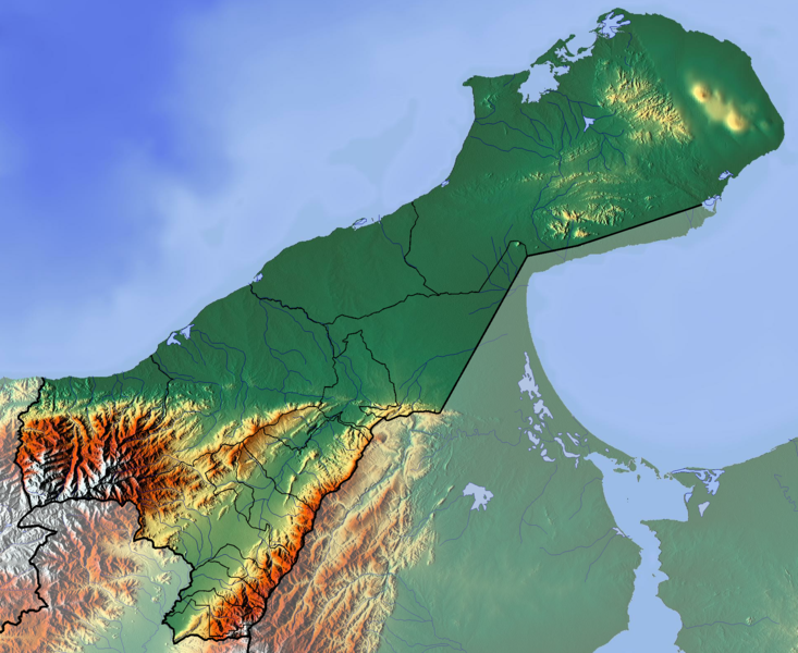
Français : La Guajira dept |
| Date | |
| Source | Own work (backgroung : http://www.maps-for-free.com) |
| Author | Dr Brains |
Licensing
[edit]
I, the copyright holder of this work, hereby publish it under the following licenses:

|
Permission is granted to copy, distribute and/or modify this document under the terms of the GNU Free Documentation License, Version 1.2 only as published by the Free Software Foundation; with no Invariant Sections, no Front-Cover Texts, and no Back-Cover Texts. A copy of the license is included in the section entitled GNU Free Documentation License. | 1.2 only |
|
|
Permission is granted to copy, distribute and/or modify this document under the terms of the GNU Free Documentation License, Version 1.3 or any later version published by the Free Software Foundation; with no Invariant Sections, no Front-Cover Texts, and no Back-Cover Texts. A copy of the license is included in the section entitled GNU Free Documentation License.
|
If this file is eligible for relicensing, it may also be used under the Creative Commons Attribution-ShareAlike 3.0 license. The relicensing status of this image needs to be manually reviewed by an experienced user. You can help.
|
You may select the license of your choice.
File history
Click on a date/time to view the file as it appeared at that time.
| Date/Time | Thumbnail | Dimensions | User | Comment | |
|---|---|---|---|---|---|
| current | 13:44, 9 June 2012 | | 1,925 × 1,575 (3.35 MB) | Dr Brains (talk | contribs) |
You cannot overwrite this file.
File usage on Commons
The following 3 pages use this file:
File usage on other wikis
The following other wikis use this file:
- Usage on bg.wikipedia.org
- Usage on en.wikipedia.org
- Mosque of Omar Ibn Al-Khattab
- La Guajira Department
- Module:Location map/data/Colombia La Guajira Department/doc
- Cesar-Ranchería Basin
- Cocinetas Basin
- Macarao Formation
- Siamaná Formation
- Uitpa Formation
- Jimol Formation
- Castilletes Formation
- Ware Formation
- Module:Location map/data/Colombia La Guajira Department
- La Guajira Terrane
- Usage on es.wikipedia.org
- Cabo de la Vela
- Punta Gallinas
- Puerto Bolívar (La Guajira)
- Cerro La Teta
- Bahía Honda (Colombia)
- Cerro Palúa
- Wikiproyecto:Ilustración/Taller de Cartografía/Realizaciones/América del Sur
- Serranía de Macuira
- Plantilla:Mapa de localización de La Guajira
- Formación Cerrejón
- Bahía Hondita
- Bahía Portete
- Montes de Oca (Guajira)
- Cerro Cerrejón
- Formación Castilletes
- Usage on fa.wikipedia.org
- Usage on fr.wikipedia.org
- La Guajira
- Punta Gallinas
- Serranía de Macuira
- Parc national naturel de Macuira
- Maicao
- Urumita
- Manaure (La Guajira)
- Villanueva (La Guajira)
- Uribia
- San Juan del Cesar
- La Jagua del Pilar
- Hatonuevo
- Fonseca (La Guajira)
- El Molino (La Guajira)
- Distracción
- Dibulla
- Barrancas (La Guajira)
- Modèle:Géolocalisation/La Guajira
- Modèle:Géolocalisation/La Guajira/Documentation
View more global usage of this file.