File:LASB K Hellwig 0272.jpg
Jump to navigation
Jump to search

Size of this preview: 725 × 599 pixels. Other resolutions: 290 × 240 pixels | 581 × 480 pixels | 929 × 768 pixels | 1,239 × 1,024 pixels | 2,478 × 2,048 pixels | 7,670 × 6,340 pixels.
Original file (7,670 × 6,340 pixels, file size: 15.2 MB, MIME type: image/jpeg)
Captions
Captions
Add a one-line explanation of what this file represents
Summary[edit]
| Description |
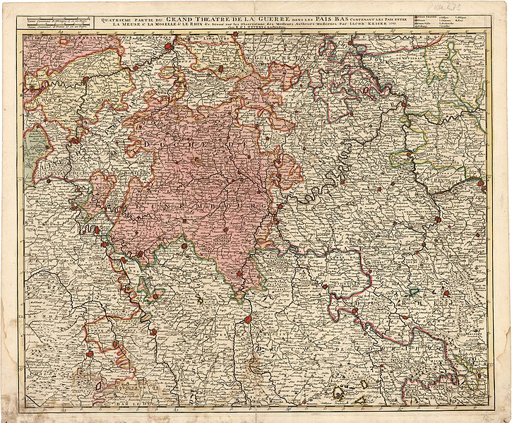
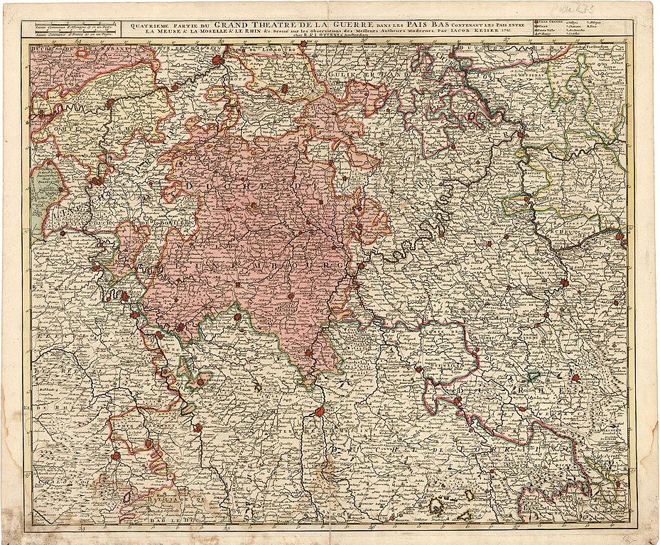
Deutsch: Kriegskarte der Saar-Mosel-Region und Nachbargebiete (QUATRIEME PARTIE DU GRAND THEATRE DE LA GUERRE DANS LES PAIS BAS CONTENANT LES PAIS ENTRE LA MEUSE & LA MOSELLE & LE RHIN & Dressé sur les Observations des Meilleurs Autheurs Modernes Par IACOB KEISER 1745.) - Kupferstich in altem Kolorit - französisch - 54,1 x 64,2 cm - 1745 |
| Date | |
| Source | Landesarchiv Saarbrücken, Kartensammlung Hellwig Nr. 272 |
| Author | Keizer, Jacob |
Licensing[edit]
| Media uploaded by user LandesarchivSaarbrücken are released under CC-BY-SA 3.0 DE. |
This file is licensed under the Creative Commons Attribution-Share Alike 3.0 Germany license. Attribution: Landesarchiv Saarbrücken, Bestand K Hellwig, Nr. 0272, Urheber Jacob Keizer / CC-BY-SA 3.0 DE
 |
File history
Click on a date/time to view the file as it appeared at that time.
| Date/Time | Thumbnail | Dimensions | User | Comment | |
|---|---|---|---|---|---|
| current | 13:05, 11 May 2021 | | 7,670 × 6,340 (15.2 MB) | LandesarchivSaarbrücken (talk | contribs) | Uploaded a work by Keizer, Jacob from Landesarchiv Saarbrücken, Kartensammlung Hellwig Nr. 272 with UploadWizard |
You cannot overwrite this file.
File usage on Commons
The following page uses this file: