File:Kulap 2017-07-25 0324Z.jpg
Jump to navigation
Jump to search

Size of this preview: 763 × 600 pixels. Other resolutions: 306 × 240 pixels | 611 × 480 pixels | 977 × 768 pixels | 1,280 × 1,006 pixels | 2,560 × 2,012 pixels | 3,736 × 2,936 pixels.
Original file (3,736 × 2,936 pixels, file size: 2.22 MB, MIME type: image/jpeg)
Captions
Captions
Add a one-line explanation of what this file represents
Summary
[edit]| Description |
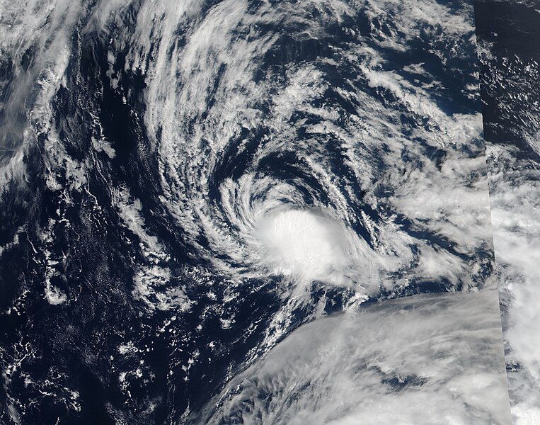
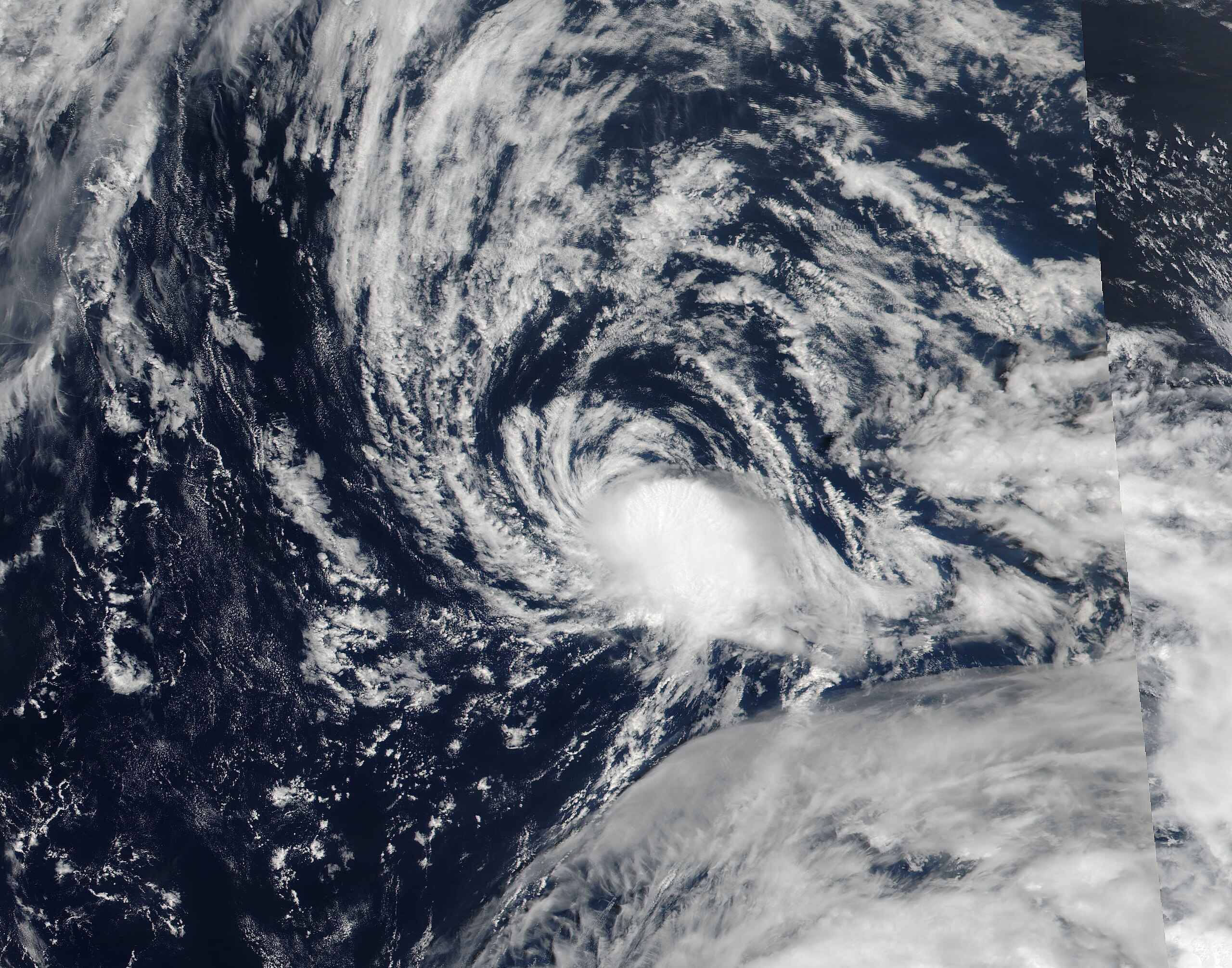
English: Tropical Storm Kulap (09W) in the northern Pacific |
| Date | |
| Source | https://lance.modaps.eosdis.nasa.gov/cgi-bin/imagery/single.cgi?image=NoruKulap.A2017206.0324.375m.jpg |
| Author | National Aeronautics and Space Administration, LANCE/EOSDIS Rapid Response, captured on Suomi NPP satellite |
| Other versions | |
| Metadata | https://lance.modaps.eosdis.nasa.gov/cgi-bin/imagery/single.cgi?metadata=NoruKulap.A2017206.0324.txt |

| Camera location | | View this and other nearby images on: OpenStreetMap |
|---|
Licensing
[edit]
| This file is in the public domain in the United States because it was solely created by NASA. NASA copyright policy states that "NASA material is not protected by copyright unless noted". (See Template:PD-USGov, NASA copyright policy page or JPL Image Use Policy.) | ||
 |
Warnings:
|
File history
Click on a date/time to view the file as it appeared at that time.
| Date/Time | Thumbnail | Dimensions | User | Comment | |
|---|---|---|---|---|---|
| current | 09:55, 15 September 2023 | | 3,736 × 2,936 (2.22 MB) | Nino Marakot (talk | contribs) | Gallery crop |
| 09:32, 8 September 2018 |  | 2,687 × 3,200 (1.42 MB) | Nino Marakot (talk | contribs) | File:Noru & Kulap 2017-07-25 0324Z.jpg cropped 47 % horizontally, 52 % vertically using CropTool with precise mode. | |
| 03:06, 30 September 2017 |  | 985 × 622 (168 KB) | A1Cafel (talk | contribs) | User created page with UploadWizard |
You cannot overwrite this file.
File usage on Commons
The following 2 pages use this file: