File:Kievan Rus in 1237 (ru).svg
Jump to navigation
Jump to search

Size of this PNG preview of this SVG file: 552 × 599 pixels. Other resolutions: 221 × 240 pixels | 442 × 480 pixels | 708 × 768 pixels | 944 × 1,024 pixels | 1,888 × 2,048 pixels | 1,200 × 1,302 pixels.
Original file (SVG file, nominally 1,200 × 1,302 pixels, file size: 342 KB)
Captions
Captions
Add a one-line explanation of what this file represents
See Image:Rus de Kiev en 1237.gif for the Spanish version.
Summary[edit]
.svg&action=edit§ion=1)
| Description |
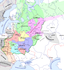
English: Map of Russia in 1237
Русский: Карта Руси в 1237 г. |
| Date | |
| Source | Own work |
| Author | Hellerick (talk) |
| Other versions |
Derivative works of this file: |
.svg)
.svg)
Licensing[edit]
.svg&action=edit§ion=2)
I, the copyright holder of this work, hereby publish it under the following licenses:

|
Permission is granted to copy, distribute and/or modify this document under the terms of the GNU Free Documentation License, Version 1.2 or any later version published by the Free Software Foundation; with no Invariant Sections, no Front-Cover Texts, and no Back-Cover Texts. A copy of the license is included in the section entitled GNU Free Documentation License. |
This file is licensed under the Creative Commons Attribution-Share Alike 3.0 Unported license.
- You are free:
- to share – to copy, distribute and transmit the work
- to remix – to adapt the work
- Under the following conditions:
- attribution – You must give appropriate credit, provide a link to the license, and indicate if changes were made. You may do so in any reasonable manner, but not in any way that suggests the licensor endorses you or your use.
- share alike – If you remix, transform, or build upon the material, you must distribute your contributions under the same or compatible license as the original.
You may select the license of your choice.
File history
Click on a date/time to view the file as it appeared at that time.
| Date/Time | Thumbnail | Dimensions | User | Comment | |
|---|---|---|---|---|---|
| current | 08:29, 14 February 2017 | | 1,200 × 1,302 (342 KB) | -PhoeniX- (talk | contribs) | неверно указаны признанные современные границы государств (красным цветом) |
| 21:38, 21 February 2015 |  | 1,200 × 1,302 (335 KB) | Nicolay Sidorov (talk | contribs) | + de-facto borders (dashed line) | |
| 14:38, 24 June 2008 |  | 1,200 × 1,302 (342 KB) | Hellerick (talk | contribs) | Map of Kievan Rus in 1237 (in Russian) |
You cannot overwrite this file.
File usage on Commons
The following 5 pages use this file:
.svg)
.svg)
File usage on other wikis
The following other wikis use this file:
- Usage on ba.wikipedia.org
- Usage on be-tarask.wikipedia.org
- Usage on be.wikipedia.org
- Usage on bg.wikipedia.org
- Usage on cs.wikipedia.org
- Usage on cv.wikipedia.org
- Usage on et.wikipedia.org
- Usage on he.wikipedia.org
- Usage on hy.wikipedia.org
- Usage on io.wikipedia.org
- Usage on lv.wikipedia.org
- Usage on mn.wikipedia.org
- Usage on pt.wikipedia.org
- Usage on ru.wikipedia.org
- Русь
- Липецкая область
- Галицко-Волынское княжество
- Распад Киевской Руси
- Туровское княжество
- Великое княжество Рязанское
- История Бердичева
- Портал:Древняя Русь
- Киевское княжество
- Черниговское княжество
- Великое княжество Владимирское
- Русские княжества
- Объединение Руси
- Диалекты русского языка
- Южное наречие русского языка
- Новгородско-норвежский договор (1326)
- Проект:История России/Карты
- История Удмуртии
- Участник:Programmer71/Расселение восточных славян
- Портал:Древняя Русь/Княжества
- Участник:Любослов Езыкин/Южное наречие русского языка
- Овручское княжество
View more global usage of this file.
.svg)
Metadata
.svg&oldid=832186405)
Categories:
- Maps of Kievan Rus
- Maps of Rus' principalities
- Maps of the Republic of Novgorod
- Maps of the history of Russia in Russian
- Grand Duchy of Ryazan
- Volga Bulgaria
- Maps of the history of Ukraine in the Middle Ages
- Maps of the Bashkirs
- Old maps of the history of Ukraine
- Maps of the history of Bulgars in the 13th century