File:Kermadec - Landsat OLI 70.png
Jump to navigation
Jump to search

Size of this preview: 270 × 600 pixels. Other resolutions: 108 × 240 pixels | 216 × 480 pixels | 345 × 768 pixels | 461 × 1,024 pixels | 921 × 2,048 pixels | 4,500 × 10,000 pixels.
Original file (4,500 × 10,000 pixels, file size: 19.28 MB, MIME type: image/png)
Captions
Captions
Add a one-line explanation of what this file represents
Summary
[edit]
| Description |
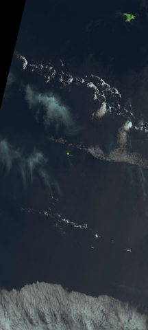
Polski: Łuk wysp Kermadec (Nowa Zelandia), mozaika zdjęć sondy Landsat 8
English: Kermadec Islands arc (New Zealand), mosaic of Landsat 8 images |
| Date | |
| Source | USGS: LandsatLook Viewer |
| Author | USGS/NASA Landsat Program; found and cropped by Szczureq |
Licensing
[edit]
This image is in the public domain in the United States because it only contains materials that originally came from the United States Geological Survey, an agency of the United States Department of the Interior. For more information, see the official USGS copyright policy.
|
| Annotations | This image is annotated: View the annotations at Commons |
File history
Click on a date/time to view the file as it appeared at that time.
| Date/Time | Thumbnail | Dimensions | User | Comment | |
|---|---|---|---|---|---|
| current | 16:36, 15 December 2015 | | 4,500 × 10,000 (19.28 MB) | Szczureq (talk | contribs) | User created page with UploadWizard |
You cannot overwrite this file.
File usage on Commons
The following 2 pages use this file:
File usage on other wikis
The following other wikis use this file:
- Usage on ca.wikipedia.org
- Usage on pl.wikipedia.org
- Usage on www.wikidata.org