File:Karte von Mittelpalaestina (FL6881879 2366924).jpg
Jump to navigation
Jump to search

Size of this preview: 717 × 600 pixels. Other resolutions: 287 × 240 pixels | 574 × 480 pixels | 918 × 768 pixels | 1,224 × 1,024 pixels | 2,448 × 2,048 pixels | 7,420 × 6,208 pixels.
Original file (7,420 × 6,208 pixels, file size: 60.21 MB, MIME type: image/jpeg)
Captions
Captions
Add a one-line explanation of what this file represents
Summary[edit]
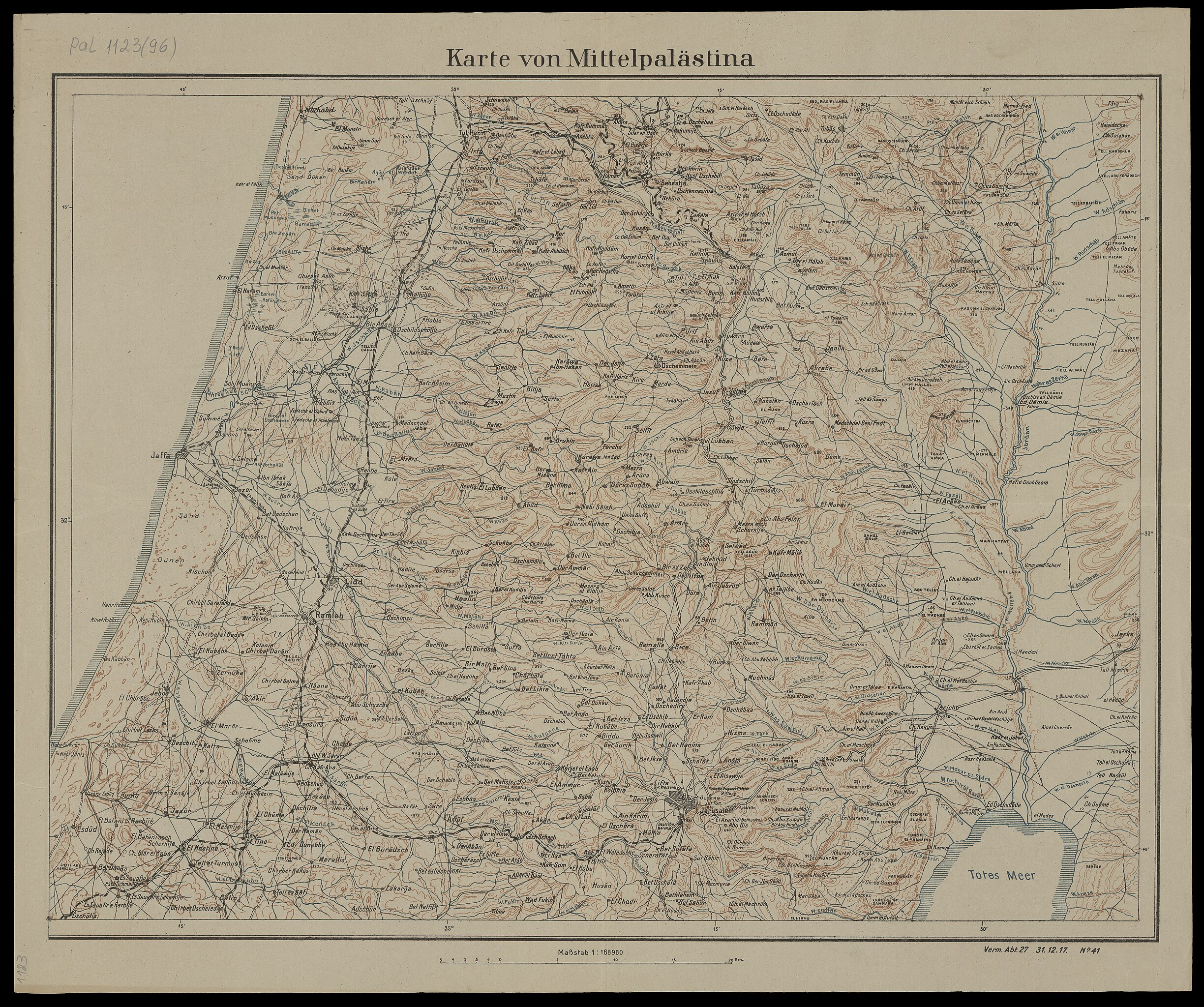
| Karte von Mittelpalaestina
( |
||||||||||||||||||||||||
|---|---|---|---|---|---|---|---|---|---|---|---|---|---|---|---|---|---|---|---|---|---|---|---|---|
| Title |
Karte von Mittelpalaestina |
|||||||||||||||||||||||
| Description |
Karte von Mittelpalaestina. Verm. Abt.27 31.12.17 No.41. |
|||||||||||||||||||||||
| Language | German | |||||||||||||||||||||||
| Publication date | 1917 | |||||||||||||||||||||||
| Collection |
|
|||||||||||||||||||||||
| Current location |
|
|||||||||||||||||||||||
| Notes | ||||||||||||||||||||||||
| scale | 1:168960 cm | |||||||||||||||||||||||
| IE PID | IE6881877 | |||||||||||||||||||||||
| Rosetta filename | FL6881879 | |||||||||||||||||||||||
| NNL item ID (P3959) | 990023669240205171 | |||||||||||||||||||||||
| search Merhav catalog | German | |||||||||||||||||||||||
| search Merhav catalog | World War, 1914-1918Eretz IsraelMaps | |||||||||||||||||||||||
| Source/Photographer |
|
|||||||||||||||||||||||
| Other versions | ||||||||||||||||||||||||
| Jpg / Tif version |
|
|||||||||||||||||||||||

.jpg)

.jpg&action=edit§ion=1)
Licensing[edit]
.jpg&action=edit§ion=2)
This work was published before January 1, 1918 and it is anonymous or pseudonymous due to unknown authorship. It is in the public domain in the United States as well as countries and areas where the copyright terms of anonymous or pseudonymous works are 106 years or fewer since publication.
|
File history
Click on a date/time to view the file as it appeared at that time.
| Date/Time | Thumbnail | Dimensions | User | Comment | |
|---|---|---|---|---|---|
| current | 13:30, 28 July 2023 | | 7,420 × 6,208 (60.21 MB) | Geagea (talk | contribs) | pattypan 22.03 |
You cannot overwrite this file.
File usage on Commons
The following page uses this file:
.jpg&oldid=787630627)