File:Karte von Löwenstein und Umgebung 1750s.jpg
Jump to navigation
Jump to search

Size of this preview: 790 × 600 pixels. Other resolutions: 316 × 240 pixels | 632 × 480 pixels | 1,012 × 768 pixels | 1,280 × 972 pixels | 2,560 × 1,943 pixels | 3,982 × 3,023 pixels.
Original file (3,982 × 3,023 pixels, file size: 2.01 MB, MIME type: image/jpeg)
Captions
Captions
Add a one-line explanation of what this file represents
Summary
[edit]
| Description |
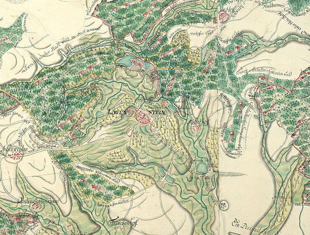
Deutsch: Karte von Löwenstein und Umgebung, entstanden zwischen 1751 und 1759 (StAWt F K 263). Die Karte ist ungefähr gesüdet. |
| Date | between 1751 and 1759 |
| Source | http://www.leo-bw.de/web/guest/themen/landesgeschichte/grafen-und-fursten-von-lowenstein-wertheim |
| Author | Unknown author |
| Other versions | Detail: File:Karte Bleichsee Loewenstein 1750s.jpg |
Licensing
[edit]
|
This work is in the public domain in its country of origin and other countries and areas where the copyright term is the author's life plus 100 years or fewer. | |
| This file has been identified as being free of known restrictions under copyright law, including all related and neighboring rights. | |
File history
Click on a date/time to view the file as it appeared at that time.
| Date/Time | Thumbnail | Dimensions | User | Comment | |
|---|---|---|---|---|---|
| current | 12:48, 30 April 2012 | | 3,982 × 3,023 (2.01 MB) | AndreasPraefcke (talk | contribs) |
You cannot overwrite this file.
File usage on Commons
The following page uses this file:
File usage on other wikis
The following other wikis use this file:
- Usage on de.wikipedia.org