File:Karte von Bangladesch.svg

Original file (SVG file, nominally 1,145 × 1,442 pixels, file size: 1.19 MB)
Captions
Captions
Summary
[edit]| Description |
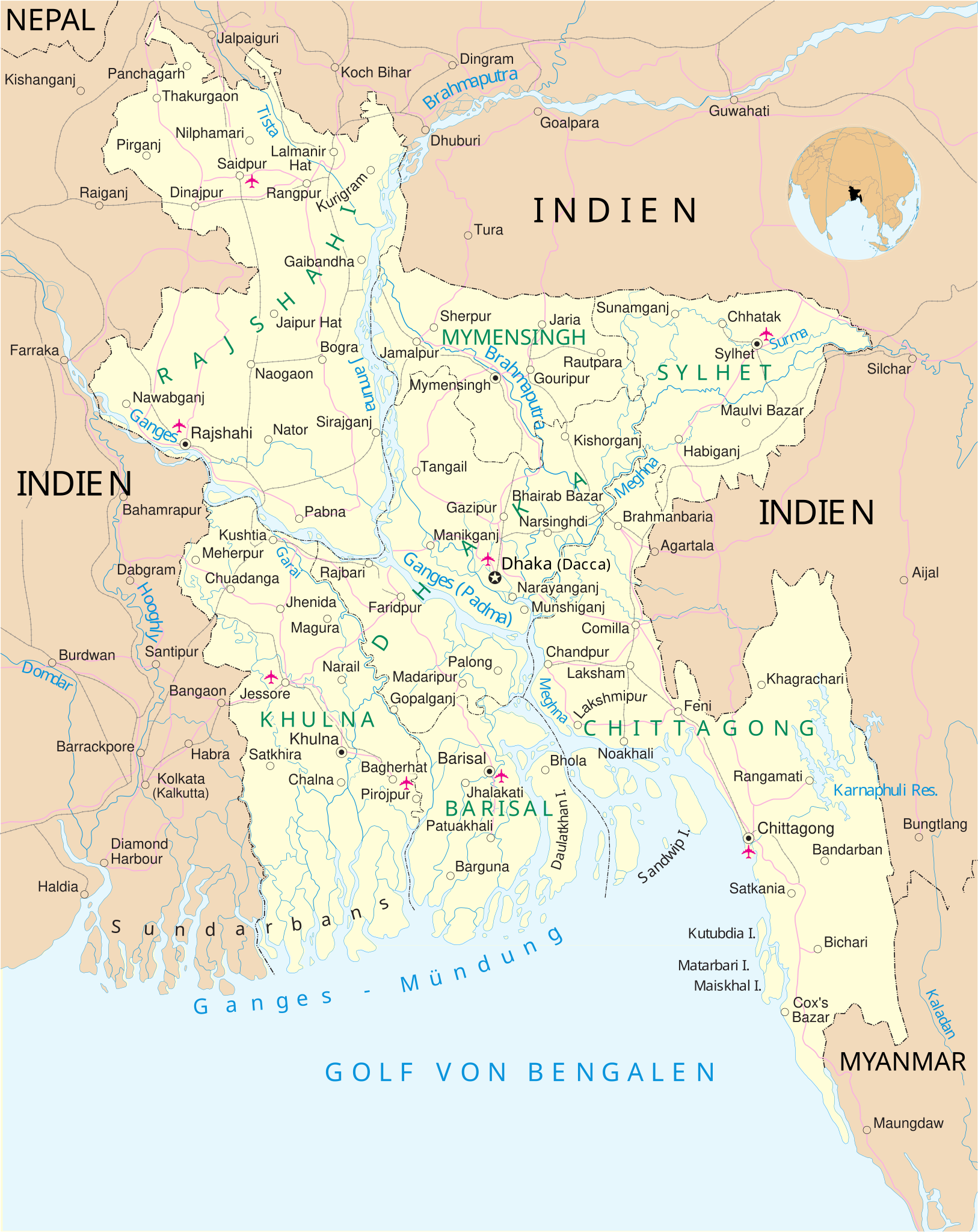
Deutsch: Karte von Bangladesch.
English: Map of Bangladesh |
|||||
| Date | ||||||
| Source | modified from United Nations map of Bangladesh, | |||||
| Author | Furfur | |||||
| Permission (Reusing this file) |
I, the copyright holder of this work, hereby publish it under the following licenses:
This file is licensed under the Creative Commons Attribution-Share Alike 4.0 International license.
You may select the license of your choice.
|
|||||
| Validation/Created with | This vector image was created with Adobe Illustrator. |


File history
Click on a date/time to view the file as it appeared at that time.
| Date/Time | Thumbnail | Dimensions | User | Comment | |
|---|---|---|---|---|---|
| current | 16:37, 2 March 2016 | | 1,145 × 1,442 (1.19 MB) | Furfur (talk | contribs) | Bildgröße skaliert (200 %) |
| 10:07, 28 February 2016 |  | 572 × 720 (1.08 MB) | Furfur (talk | contribs) | Detail (Mymensingh) | |
| 10:01, 28 February 2016 |  | 572 × 720 (1.08 MB) | Furfur (talk | contribs) | +Division Mymensingh | |
| 09:32, 1 February 2016 |  | 572 × 720 (1.07 MB) | Furfur (talk | contribs) | SVG a little bit simplified | |
| 23:50, 30 January 2016 |  | 573 × 721 (1.04 MB) | Furfur (talk | contribs) | +Division Sylhet, + Geolokalisierung | |
| 23:49, 22 January 2016 |  | 573 × 721 (890 KB) | Furfur (talk | contribs) | ... hoffentlich jetzt valides SVG ... | |
| 23:40, 22 January 2016 |  | 573 × 721 (919 KB) | Furfur (talk | contribs) | neuer Versuch mit Adobe Illustrator ... | |
| 22:16, 20 January 2016 |  | 582 × 730 (1.08 MB) | Furfur (talk | contribs) | == {{int:filedesc}} == {{Information |Description={{de|1=Karte von Bangladesch.}} {{en|1=Map of Bangladesh}} |Source=modified from [http://www.un.org/Depts/Cartographic/map/profile/banglade.pdf United Nations map of Bangladesh], |Date=2016-01-20 |Auth... |
You cannot overwrite this file.
File usage on Commons
The following page uses this file: