File:Karte KZ-Außenlagerkomplex Kaufering.png
Jump to navigation
Jump to search
Size of this preview: 800 × 451 pixels. Other resolutions: 320 × 180 pixels | 640 × 361 pixels | 1,024 × 577 pixels | 1,280 × 722 pixels | 2,560 × 1,443 pixels | 3,894 × 2,195 pixels.
Original file (3,894 × 2,195 pixels, file size: 3.74 MB, MIME type: image/png)
Captions
Captions
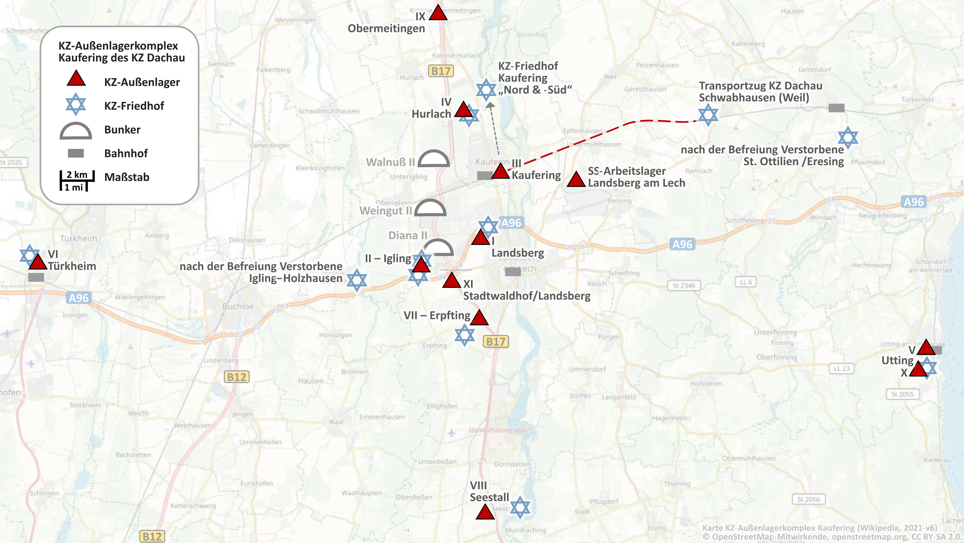
Map of subcamp system of concentration camp subcamp Kaufering (Germany)
Summary[edit]
| Description |
English: Map of subcamp system of concentration camp subcamp Kaufering (Germany)
© OpenStreetMap-Mitwirkende, openstreetmap.org, CC BY-SA 2.0. |
| Date | |
| Source | https://www.openstreetmap.org/#map=12/48.0563/10.8071&layers=T |
| Author |
© OpenStreetMap-Mitwirkende, openstreetmap.org, CC BY-SA 2.0. Ergänzt um die Standorte des KZ-Außenlagerkomplexes Kaufering. (Sollte etwas nicht stimmen, bitte auf meiner Diskussions-Seite melden - wird dann korrigiert) |
| Other versions |
|


Licensing[edit]
This file is licensed under the Creative Commons Attribution-Share Alike 2.0 Generic license.
- You are free:
- to share – to copy, distribute and transmit the work
- to remix – to adapt the work
- Under the following conditions:
- attribution – You must give appropriate credit, provide a link to the license, and indicate if changes were made. You may do so in any reasonable manner, but not in any way that suggests the licensor endorses you or your use.
- share alike – If you remix, transform, or build upon the material, you must distribute your contributions under the same or compatible license as the original.
File history
Click on a date/time to view the file as it appeared at that time.
| Date/Time | Thumbnail | Dimensions | User | Comment | |
|---|---|---|---|---|---|
| current | 11:47, 22 September 2021 | | 3,894 × 2,195 (3.74 MB) | Treck08 (talk | contribs) | Präz. |
| 13:40, 19 September 2021 |  | 3,911 × 2,190 (3.75 MB) | Treck08 (talk | contribs) | Friedhof-Symbole, Kontrast-Feinabstimmung | |
| 14:15, 18 September 2021 |  | 3,868 × 2,190 (3.53 MB) | Treck08 (talk | contribs) | Erg. KZ-Friedhof Kaufering Nord+Süd, Visualisierung opt. | |
| 10:39, 18 September 2021 |  | 3,894 × 2,204 (3.93 MB) | Treck08 (talk | contribs) | Opt. Beschriftung, Maßstab, Landstraßen | |
| 00:26, 18 September 2021 |  | 3,972 × 2,181 (3.34 MB) | Treck08 (talk | contribs) | Opt., Bunker | |
| 17:34, 17 September 2021 |  | 4,000 × 2,194 (4.25 MB) | Treck08 (talk | contribs) | Uploaded a work by © OpenStreetMap-Mitwirkende, openstreetmap.org, CC BY-SA 2.0. Ergänzt um die Standorte des KZ-Außenlagerkomplexes Kaufering. (Sollte etwas nicht stimmen, bitte auf meiner Diskussions-Seite melden - wird dann korrigiert) from https://www.openstreetmap.org/#map=12/48.0563/10.8071&layers=T with UploadWizard |
You cannot overwrite this file.
File usage on Commons
The following 3 pages use this file:
File usage on other wikis
The following other wikis use this file:
- Usage on de.wikipedia.org