File:Karlsruhe-Position.png
Jump to navigation
Jump to search
No higher resolution available.
Karlsruhe-Position.png (176 × 234 pixels, file size: 6 KB, MIME type: image/png)
Captions
Captions
Add a one-line explanation of what this file represents
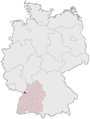
Position of Karlsruhe in Germany
Made by Geograv based on the data from:
This image was generated with OpenGeoDB. The information there is placed in the public domain, images generated from OpenGeoDB are derivative works without passing the threshold of creativity, they are therefore also public domain.
| This work is ineligible for copyright and therefore in the public domain because it consists entirely of information that is common property and contains no original authorship. |
File history
Click on a date/time to view the file as it appeared at that time.
| Date/Time | Thumbnail | Dimensions | User | Comment | |
|---|---|---|---|---|---|
| current | 05:41, 11 April 2006 | | 176 × 234 (6 KB) | Jed (talk | contribs) | Reverted to earlier revision |
| 13:23, 26 March 2006 |  | 188 × 235 (3 KB) | Jed (talk | contribs) | ||
| 23:09, 20 February 2005 |  | 176 × 234 (6 KB) | ¡0-8-15! (talk | contribs) | ||
| 20:39, 25 November 2004 |  | 188 × 235 (5 KB) | Civvi~commonswiki (talk | contribs) | Position of Karlsruhe in Germany |
You cannot overwrite this file.
File usage on Commons
The following page uses this file:
File usage on other wikis
The following other wikis use this file:
- Usage on azb.wikipedia.org
- Usage on da.wikipedia.org
- Usage on fa.wikipedia.org
- Usage on io.wikipedia.org
- Usage on ja.wikipedia.org
- Usage on mk.wikipedia.org
- Usage on oc.wikipedia.org
- Usage on pl.wikivoyage.org
- Usage on ro.wikipedia.org