File:Kalmar - KMB - 16001000307004.jpg
Jump to navigation
Jump to search

Size of this preview: 800 × 532 pixels. Other resolutions: 320 × 213 pixels | 640 × 426 pixels | 1,024 × 681 pixels | 1,280 × 852 pixels | 2,560 × 1,703 pixels | 4,148 × 2,760 pixels.
Original file (4,148 × 2,760 pixels, file size: 6.8 MB, MIME type: image/jpeg)
Captions
Captions
Add a one-line explanation of what this file represents
| Camera location | | View this and other nearby images on: OpenStreetMap |
|---|
| Kalmar
( |
|||||||||||||||||||||||||||
|---|---|---|---|---|---|---|---|---|---|---|---|---|---|---|---|---|---|---|---|---|---|---|---|---|---|---|---|
| Photographer |
|
||||||||||||||||||||||||||
| Title |
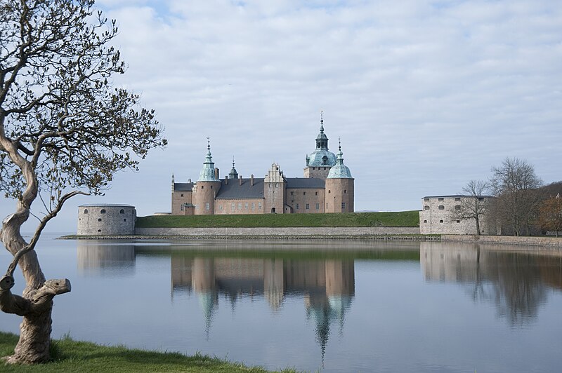
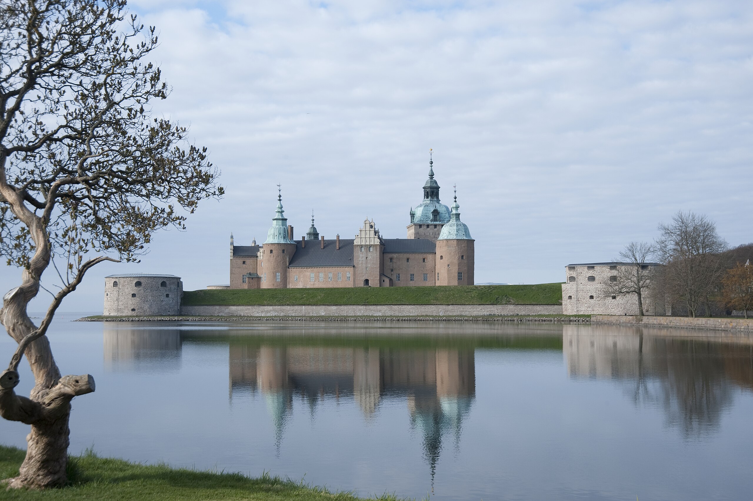
Kalmar |
||||||||||||||||||||||||||
| Original caption |
Notera Av dokumentationsskäl har originalbeskrivningen från Riksantikvarieämbetet behållits. Tillrättalägganden och alternativa beskrivningar bör införas separat från nedanstående information. Kalmar slott.Felaktigheter kan även anmälas till denna sida. Motiv: Kalmar |
||||||||||||||||||||||||||
| Description |
Kalmar slott.
|
||||||||||||||||||||||||||
| Depicted place | Sweden, Kalmar Municipality, Kalmar parish | ||||||||||||||||||||||||||
| Date | Taken on 5 May 2011 | ||||||||||||||||||||||||||
| Collection |
|
||||||||||||||||||||||||||
| Accession number | |||||||||||||||||||||||||||
| Source |
Bengt A Lundberg / Kulturmiljöbild, Riksantikvarieämbetet
|
||||||||||||||||||||||||||
| Permission (Reusing this file) |
This file is licensed under the Creative Commons Attribution 2.5 Generic license. Attribution: Bengt A Lundberg / Riksantikvarieämbetet
|
||||||||||||||||||||||||||


| Object location | | View this and other nearby images on: OpenStreetMap |
|---|
| This is a retouched picture, which means that it has been digitally altered from its original version. Modifications: Removed dust spots. Modifications made by https://pub.raa.se/visa/dokumentation/37465228-c733-4412-871e-76b996d9e4ee. The original can be found here: https://pub.raa.se/visa/dokumentation/37465228-c733-4412-871e-76b996d9e4ee.
|
File history
Click on a date/time to view the file as it appeared at that time.
| Date/Time | Thumbnail | Dimensions | User | Comment | |
|---|---|---|---|---|---|
| current | 14:57, 19 January 2024 | | 4,148 × 2,760 (6.8 MB) | VulpesVulpes42 (talk | contribs) | Försök att retuschera bort fläckar. |
| 22:27, 22 May 2023 |  | 4,148 × 2,760 (6.81 MB) | VulpesVulpes42 (talk | contribs) | Högre upplösning. | |
| 17:43, 9 June 2017 |  | 787 × 524 (88 KB) | AndreCostaWMSE-bot (talk | contribs) | {{Kulturmiljöbild-image | short title = Kalmar | original description = Kalmar slott.<br> Motiv: Kalmar<br> Nyckelord: Byggnadsminnen:Statl, Riksintressen<br> Kategori: Slott | wiki description = Kalmar slott. {{BBR|21400000394537|b}} | photographer =... |
You cannot overwrite this file.
File usage on Commons
The following 4 pages use this file:
File usage on other wikis
The following other wikis use this file:
- Usage on da.wikipedia.org
- Usage on sv.wikipedia.org