File:Kalinga sea routes.svg
Jump to navigation
Jump to search

Size of this PNG preview of this SVG file: 749 × 453 pixels. Other resolutions: 320 × 194 pixels | 640 × 387 pixels | 1,024 × 619 pixels | 1,280 × 774 pixels | 2,560 × 1,548 pixels.
Original file (SVG file, nominally 749 × 453 pixels, file size: 852 KB)
Captions
Captions
Add a one-line explanation of what this file represents

Summary[edit]
| Description |
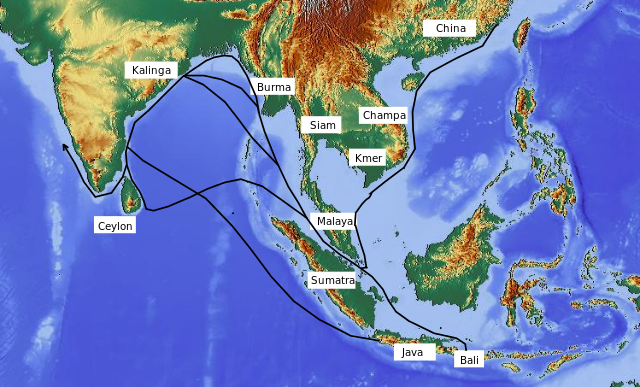
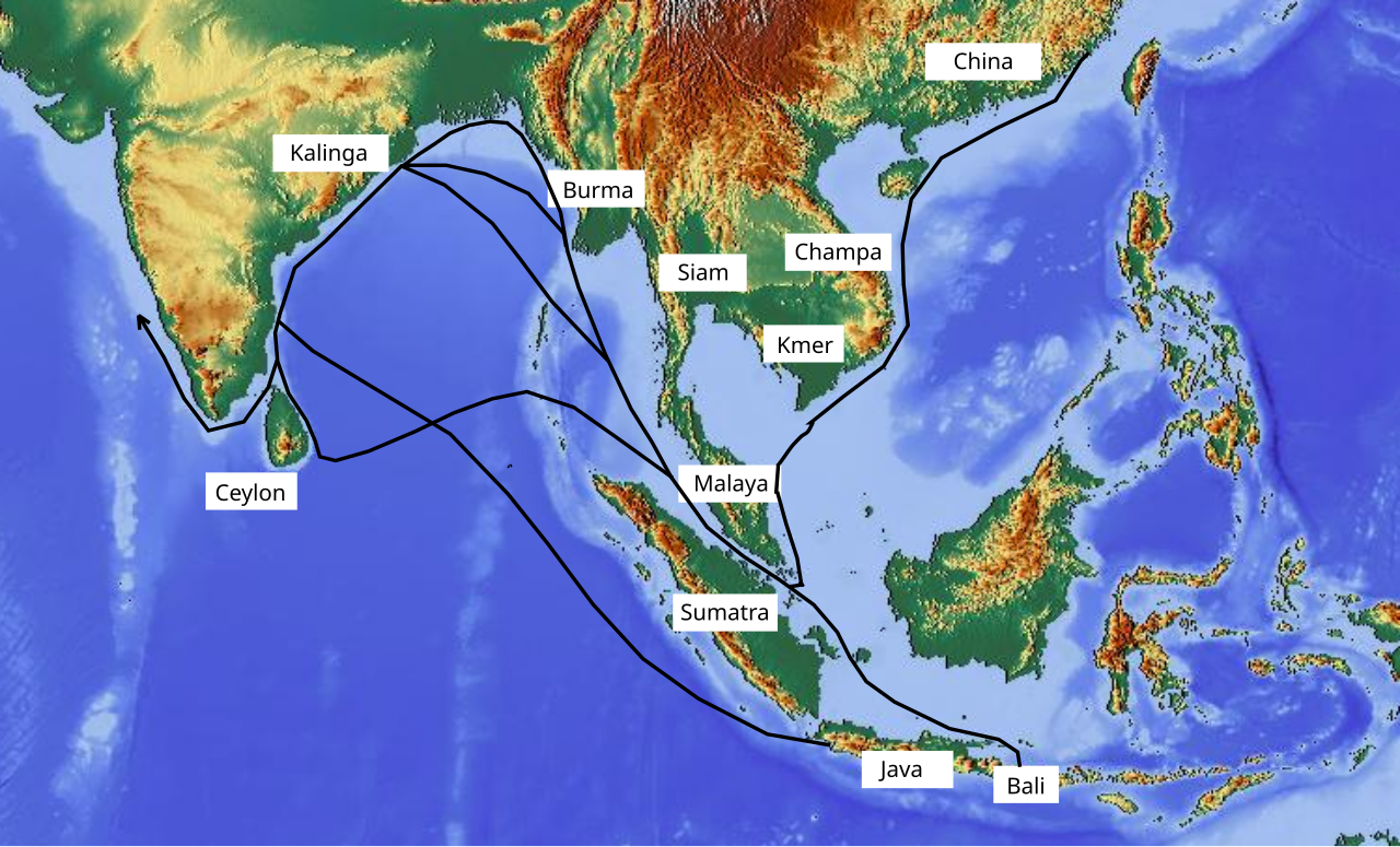
English: Map showing sea routes between Kalinga (ancient Orissa) and trading partners. |
| Date | |
| Source | http://www.maps-for-free.com annotated by author |
| Author | Aymatth2 |
Licensing[edit]
This file is licensed under the Creative Commons Attribution-Share Alike 3.0 Unported license.
- You are free:
- to share – to copy, distribute and transmit the work
- to remix – to adapt the work
- Under the following conditions:
- attribution – You must give appropriate credit, provide a link to the license, and indicate if changes were made. You may do so in any reasonable manner, but not in any way that suggests the licensor endorses you or your use.
- share alike – If you remix, transform, or build upon the material, you must distribute your contributions under the same or compatible license as the original.
File history
Click on a date/time to view the file as it appeared at that time.
| Date/Time | Thumbnail | Dimensions | User | Comment | |
|---|---|---|---|---|---|
| current | 14:06, 20 November 2010 | | 749 × 453 (852 KB) | Aymatth2 (talk | contribs) | {{Information |Description={{en|1=Map showing sea routes between Kalinga (ancient Orissa) and trading partners.}} |Source=http://www.maps-for-free.com annotated by author |Author=Aymatth2 |Date=2010-11-20 |Permission= |other_versions= }} [[Category:Oriss |
You cannot overwrite this file.
File usage on Commons
There are no pages that use this file.
File usage on other wikis
The following other wikis use this file:
- Usage on fr.wikipedia.org
- Usage on or.wikipedia.org