File:KOFF airport diagram 00544AD.svg
Jump to navigation
Jump to search

Size of this PNG preview of this SVG file: 424 × 600 pixels. Other resolutions: 170 × 240 pixels | 339 × 480 pixels | 543 × 768 pixels | 724 × 1,024 pixels | 1,448 × 2,048 pixels | 744 × 1,052 pixels.
Original file (SVG file, nominally 744 × 1,052 pixels, file size: 604 KB)
Captions
Captions
Add a one-line explanation of what this file represents
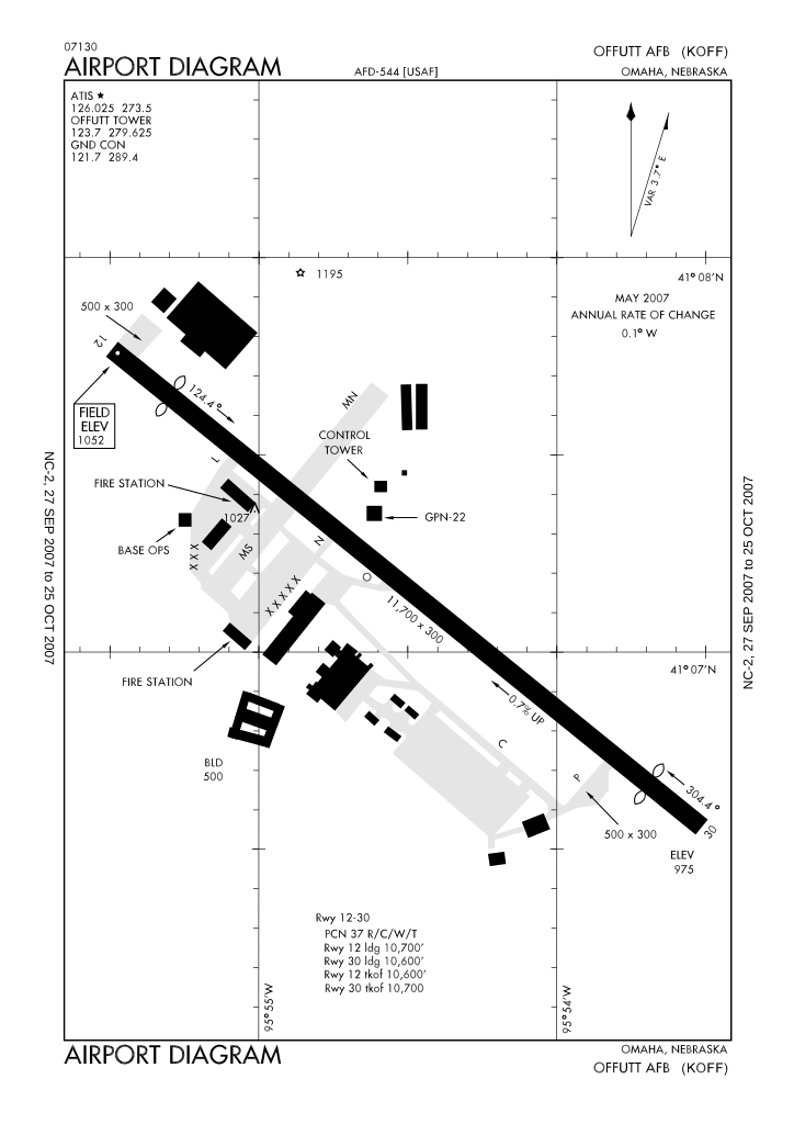
| Description | FAA airport diagram of Offutt Air Force Base (KOFF), Nebraska | |||
| Date | Effective 2007-09-27 | |||
| Source | original PDF | |||
| Author | National Aeronautical Charting Office | |||
| Permission (Reusing this file) |
|

File history
Click on a date/time to view the file as it appeared at that time.
| Date/Time | Thumbnail | Dimensions | User | Comment | |
|---|---|---|---|---|---|
| current | 04:34, 5 October 2007 | | 744 × 1,052 (604 KB) | 121a0012 (talk | contribs) | Deleted demo message. |
| 04:31, 5 October 2007 |  | 744 × 1,052 (605 KB) | 121a0012 (talk | contribs) | {{Information |Description=FAA airport diagram of w:Offutt Air Force Base (KOFF), Nebraska |Source=[http://www.naco.faa.gov/ National Aeronautical Charting Office] |Date=Effective 2007-09-27 |Permissions={{PD-USGov-FAA}} |other_versions=[http://w |
You cannot overwrite this file.
File usage on Commons
The following page uses this file: