File:Juniperus communis range map.gif
Jump to navigation
Jump to search
No higher resolution available.
Juniperus_communis_range_map.gif (664 × 580 pixels, file size: 19 KB, MIME type: image/gif)
Captions
Captions
Add a one-line explanation of what this file represents
Summary[edit]
| Description |
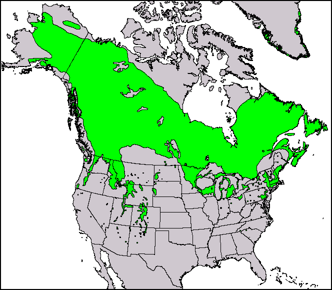
English: This North American range map of Juniperus communis, the common juniper, was published in a USGS publication: Conifers. Climate-Vegetation Atlas of North America. USGS. Retrieved on 2007-11-11. Maps and ArcView shapefiles can also be downloaded here: Little, Jr., Elbert L. Atlas. USGS. Archived from the original on 2007-07-17. Retrieved on 2007-11-11. |
|||
| Date | ||||
| Source | Thompson, Robert S.; Katherine H. Anderson and Patrick J. Bartlein (1999) Atlas of Relations Between Climatic Parameters and Distributions of Important Trees and Shrubs in North America, U.S. Geological Survey (Professional Paper 1650 A&B) | |||
| Author | Robert S. Thompson, Katherine H. Anderson, and Patrick J. Bartlein | |||
| Permission (Reusing this file) |
|
|||
| Other versions |
This and other maps were originally produced by Elbert L. Little, Jr. of the U.S. Department of Agriculture's Forest Service.  |
| Page | Caption |
|---|---|
| Species distribution | A species range map represents the region where individuals of a species can be found. This is the North American range map of Juniperus communis, the common juniper. |
Licensing[edit]
Original upload log[edit]
The original description page was here. All following user names refer to en.wikipedia.
| Date/Time | Dimensions | User | Comment |
|---|---|---|---|
| 2010-12-29 14:39:43 | 664 × 580 | Threelovemonkeys | {{Information |Description = This is a species range map of Juniperus communis, published in a USGS publication. |Source = Robert S. Thompson, Katherine H. Anderson and Patrick J. Bartlein. 1999. Atlas of Relations Between Climatic Parameters |
File history
Click on a date/time to view the file as it appeared at that time.
| Date/Time | Thumbnail | Dimensions | User | Comment | |
|---|---|---|---|---|---|
| current | 01:25, 11 April 2017 | | 664 × 580 (19 KB) | FastilyClone (talk | contribs) | Transferred from en.wikipedia (MTC!) |
You cannot overwrite this file.
File usage on Commons
The following page uses this file:
File usage on other wikis
The following other wikis use this file:
- Usage on en.wikipedia.org
- Usage on fa.wikipedia.org
- Usage on uk.wikipedia.org
- Usage on vi.wikipedia.org
- Usage on zh.wikipedia.org