File:July 2011 Thailand Flooding.jpg
Jump to navigation
Jump to search

Size of this preview: 318 × 600 pixels. Other resolutions: 127 × 240 pixels | 254 × 480 pixels | 407 × 768 pixels | 543 × 1,024 pixels | 1,086 × 2,048 pixels | 3,780 × 7,128 pixels.
Original file (3,780 × 7,128 pixels, file size: 4.68 MB, MIME type: image/jpeg)
Captions
Captions
Add a one-line explanation of what this file represents
Summary[edit]
| Description | |
| Date | |
| Source | NASA Image of the Day |
| Author | NASA/GSFC/METI/ERSDAC/JAROS, and U.S./Japan ASTER Science Team |
| Camera location | | View this and other nearby images on: OpenStreetMap |
|---|
Image captured by the Advanced Spaceborne Thermal Emission and Reflection Radiometer instrument on NASA's Terra spacecraft.
Licensing[edit]
| This file is in the public domain in the United States because it was solely created by NASA. NASA copyright policy states that "NASA material is not protected by copyright unless noted". (See Template:PD-USGov, NASA copyright policy page or JPL Image Use Policy.) | ||
 |
Warnings:
|
File history
Click on a date/time to view the file as it appeared at that time.
| Date/Time | Thumbnail | Dimensions | User | Comment | |
|---|---|---|---|---|---|
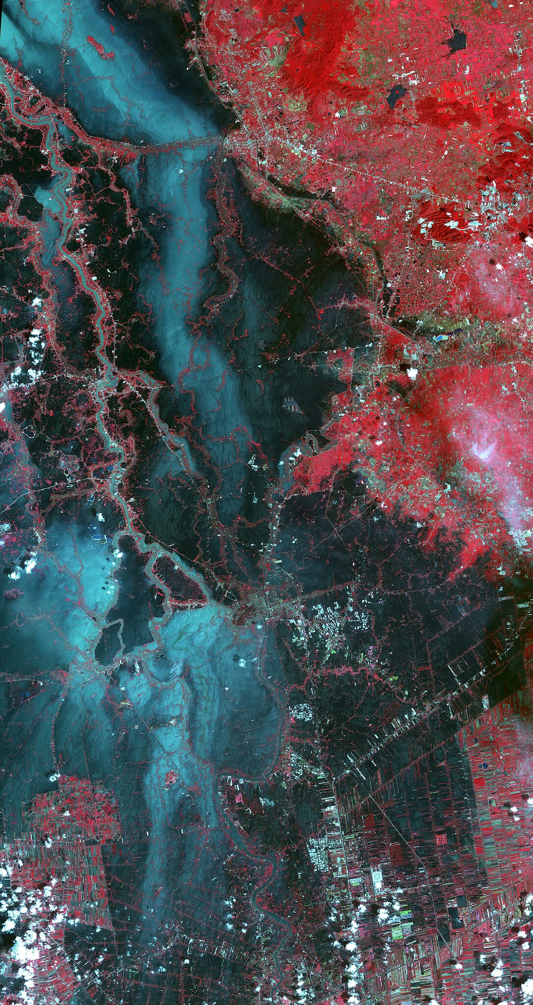
| current | 15:15, 27 October 2011 | | 3,780 × 7,128 (4.68 MB) | Originalwana (talk | contribs) | {{Information |Description ={{en|1=In this image, vegetation is displayed in red, and flooded areas are black and dark blue. Brighter blue shows sediment-laden water, and gray areas are houses, [[:Category:Build |
You cannot overwrite this file.
File usage on Commons
There are no pages that use this file.
File usage on other wikis
The following other wikis use this file:
- Usage on ilo.wikipedia.org
- Usage on incubator.wikimedia.org
- Usage on ka.wikipedia.org
- Usage on my.wikipedia.org
- Usage on sh.wikipedia.org
- Usage on te.wikipedia.org