File:Jan Mayen-Map-fr.gif
Jump to navigation
Jump to search
No higher resolution available.
Jan_Mayen-Map-fr.gif (330 × 355 pixels, file size: 5 KB, MIME type: image/gif)
Captions
Captions
Add a one-line explanation of what this file represents

|
This file has been superseded by Jan Mayen-Map-fr.svg. It is recommended to use the other file. Please note that deleting superseded images requires consent.
|

|
| Description |
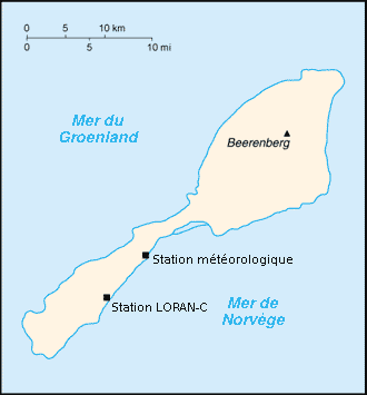
Français : Carte de l'île de Jan Mayen en français, Norvège English: Jan Mayen Island map in french, Norway |
||||||||
| Date | |||||||||
| Source | Own work | ||||||||
| Author | Rémih | ||||||||
| Permission (Reusing this file) |
I, the copyright holder of this work, hereby publish it under the following licenses:
You may select the license of your choice. This file is licensed under the Creative Commons Attribution-Share Alike 1.0 Generic license.
|

File history
Click on a date/time to view the file as it appeared at that time.
| Date/Time | Thumbnail | Dimensions | User | Comment | |
|---|---|---|---|---|---|
| current | 16:50, 24 April 2007 | | 330 × 355 (5 KB) | Rémih (talk | contribs) | {{Information |Description={{fr|Carte de l'île de Jan Mayen en français, Norvège}}{{en|Jan Mayen Island map in french, Norway}} |Source=œuvre personnelle / own work |Date=24/04/2007 |Author=Rémih |Permission={{GFDL-self}}{{cc-by-sa}} |
You cannot overwrite this file.
File usage on Commons
There are no pages that use this file.