File:Itzehoe Grabplatte an der Laurentius-Kirche DSC01650.JPG
Jump to navigation
Jump to search
Size of this preview: 450 × 600 pixels. Other resolutions: 180 × 240 pixels | 360 × 480 pixels | 576 × 768 pixels | 768 × 1,024 pixels | 1,536 × 2,048 pixels | 3,672 × 4,896 pixels.
Original file (3,672 × 4,896 pixels, file size: 8.68 MB, MIME type: image/jpeg)
Captions
Captions
Add a one-line explanation of what this file represents
Summary[edit]
| Description |
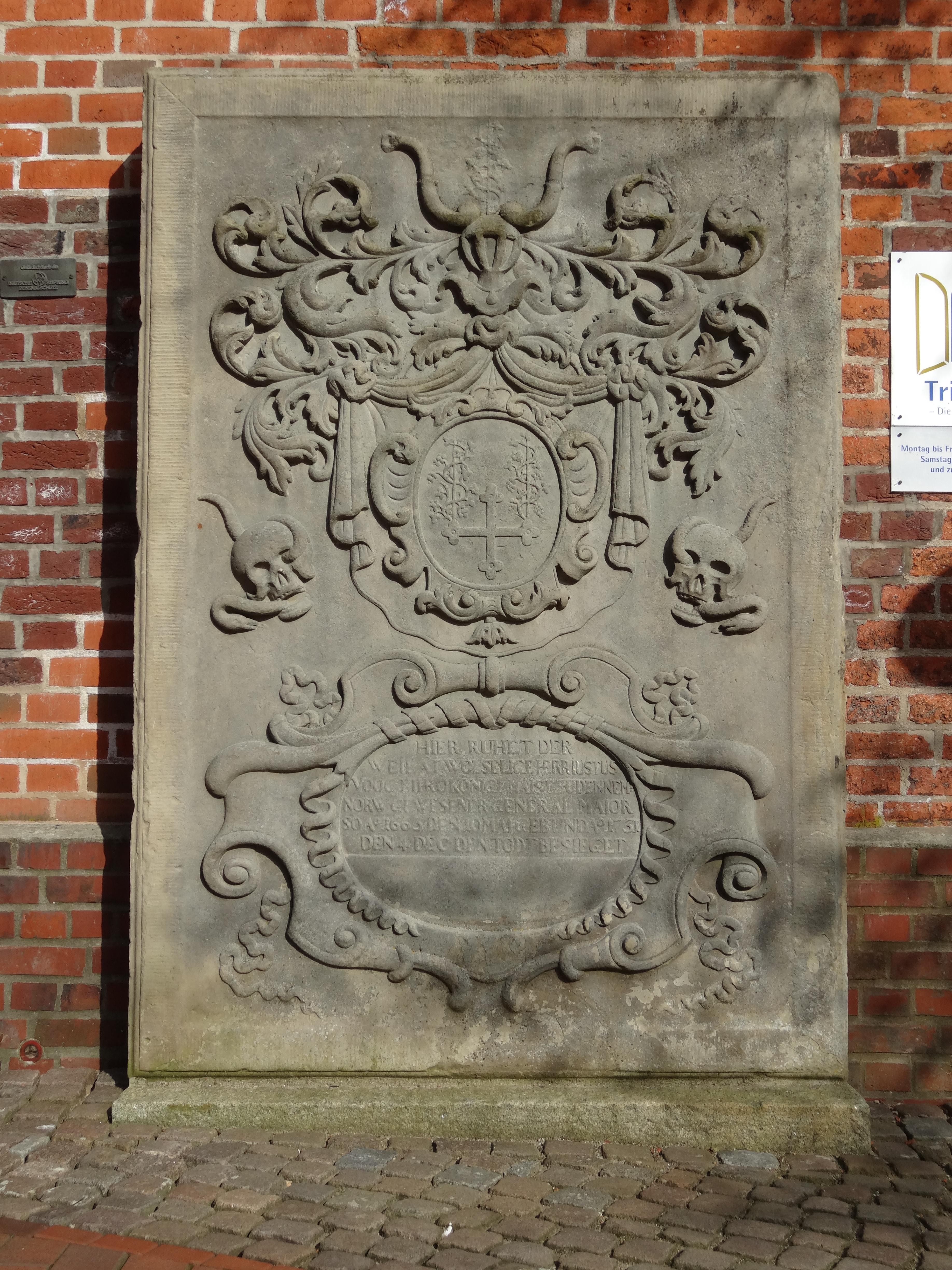
Itzehoe, Grabstein des königlich dänischen Generalmajors Justus Voogt (10. Mai 1663-4. Dezember 1731) an der Stadtkirche St. Laurentii
HIER RUHET DER |
| Date | |
| Source | Own work |
| Author | Nightflyer |
| Other versions |
siehe auch Detail:  |
| Object location | | View this and other nearby images on: OpenStreetMap |
|---|
Licensing[edit]
I, the copyright holder of this work, hereby publish it under the following licenses:

|
Permission is granted to copy, distribute and/or modify this document under the terms of the GNU Free Documentation License, Version 1.2 or any later version published by the Free Software Foundation; with no Invariant Sections, no Front-Cover Texts, and no Back-Cover Texts. A copy of the license is included in the section entitled GNU Free Documentation License. |
This file is licensed under the Creative Commons Attribution 3.0 Unported license.
- You are free:
- to share – to copy, distribute and transmit the work
- to remix – to adapt the work
- Under the following conditions:
- attribution – You must give appropriate credit, provide a link to the license, and indicate if changes were made. You may do so in any reasonable manner, but not in any way that suggests the licensor endorses you or your use.
You may select the license of your choice.
File history
Click on a date/time to view the file as it appeared at that time.
| Date/Time | Thumbnail | Dimensions | User | Comment | |
|---|---|---|---|---|---|
| current | 21:14, 29 April 2013 | | 3,672 × 4,896 (8.68 MB) | Nightflyer (talk | contribs) | {{Information |Description=Itzehoe, einer der Grabstein an der Stadtkirche St. Laurentii :Inschrift: :HIER RUHET DER :WEII AT WOL SELIGE HERR JUSTUS :VOGT IHRO KONIG...AIS... UDNNEM :NORW.........GENERAL MAJ... |
You cannot overwrite this file.
File usage on Commons
The following 2 pages use this file:
_DSC01816.JPG)
File usage on other wikis
The following other wikis use this file:
- Usage on de.wikipedia.org