File:Irrigazione mesopotamica.svg
Jump to navigation
Jump to search

Size of this PNG preview of this SVG file: 476 × 245 pixels. Other resolutions: 320 × 165 pixels | 640 × 329 pixels | 1,024 × 527 pixels | 1,280 × 659 pixels | 2,560 × 1,318 pixels.
Original file (SVG file, nominally 476 × 245 pixels, file size: 11 KB)
Captions
Captions
Add a one-line explanation of what this file represents
Summary[edit]
| Description |
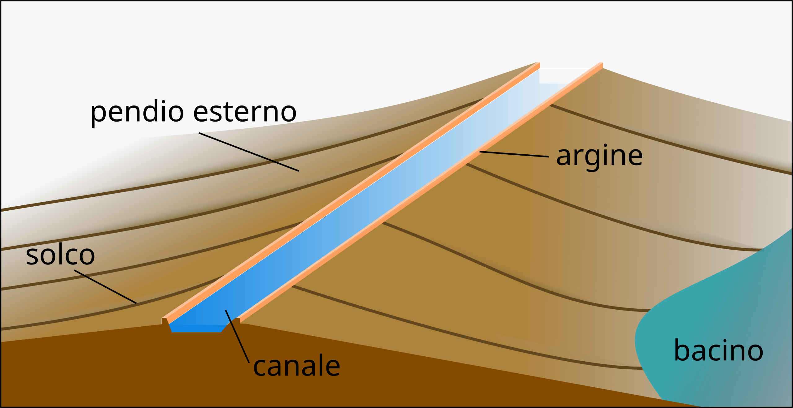
Italiano: Irrigazione a solco mesopotamica: i campi, in leggera pendenza, venivano irrigati a partire da un canale centrale. L'acqua terminava in bacini di raccolta o in paludi. |
| Date | |
| Source |
Own work Description of the irrigation technique from Mario Liverani (1998) (in italian) Uruk: la prima città, Laterza, pp. 20−21 |
| Author | Ruthven |
| SVG development |
Licensing[edit]
I, the copyright holder of this work, hereby publish it under the following license:
| This file is made available under the Creative Commons CC0 1.0 Universal Public Domain Dedication. | |
| The person who associated a work with this deed has dedicated the work to the public domain by waiving all of their rights to the work worldwide under copyright law, including all related and neighboring rights, to the extent allowed by law. You can copy, modify, distribute and perform the work, even for commercial purposes, all without asking permission.
|

|
This SVG file contains embedded text that can be translated into your language, using any capable SVG editor, text editor or the SVG Translate tool. For more information see: About translating SVG files. |
File history
Click on a date/time to view the file as it appeared at that time.
| Date/Time | Thumbnail | Dimensions | User | Comment | |
|---|---|---|---|---|---|
| current | 14:19, 17 January 2023 | | 476 × 245 (11 KB) | Ruthven (talk | contribs) | Uploaded own work with UploadWizard |
You cannot overwrite this file.
File usage on Commons
The following page uses this file:
File usage on other wikis
The following other wikis use this file:
- Usage on it.wikipedia.org