File:Iron Dome radar.jpg
Jump to navigation
Jump to search

Size of this preview: 800 × 598 pixels. Other resolutions: 320 × 239 pixels | 640 × 478 pixels | 968 × 723 pixels.
Original file (968 × 723 pixels, file size: 278 KB, MIME type: image/jpeg)
Captions
Captions
Add a one-line explanation of what this file represents
Summary[edit]
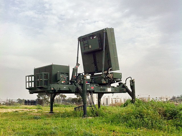
| Description | Elta EL/M-2084 radar used by the Iron Dome surface-to-air missile system. |
| Date | (UTC) |
| Source | This file was derived from: |
| Author |
|
| This is a retouched picture, which means that it has been digitally altered from its original version. Modifications: light, color, cropped.
|
Licensing[edit]
I, the copyright holder of this work, hereby publish it under the following license:
This file is licensed under the Creative Commons Attribution-Share Alike 2.0 Generic license.
- You are free:
- to share – to copy, distribute and transmit the work
- to remix – to adapt the work
- Under the following conditions:
- attribution – You must give appropriate credit, provide a link to the license, and indicate if changes were made. You may do so in any reasonable manner, but not in any way that suggests the licensor endorses you or your use.
- share alike – If you remix, transform, or build upon the material, you must distribute your contributions under the same or compatible license as the original.
Original upload log[edit]
This image is a derivative work of the following images:
- File:Flickr_-_Israel_Defense_Forces_-_Iron_Dome_System_Guarding_the_Skies_of_Israel.jpg licensed with Cc-by-sa-2.0
- 2012-06-13T21:31:32Z Rotatebot 968x1296 (383554 Bytes) Bot: Image rotated by 270° (EXIF-Orientation set from 6 to 1, rotated 0°)
- 2012-06-13T20:24:29Z Matanya 1296x968 (383558 Bytes) == {{int:filedesc}} =={{Information |Description=March 12, 2012 Terrorists in the Gaza Strip have fired more than 200 rockets since this Friday, striking major population centers in southern Israel. More than one millio
Uploaded with derivativeFX
File history
Click on a date/time to view the file as it appeared at that time.
| Date/Time | Thumbnail | Dimensions | User | Comment | |
|---|---|---|---|---|---|
| current | 12:23, 15 June 2012 | | 968 × 723 (278 KB) | NatanFlayer (talk | contribs) | == {{int:filedesc}} == {{Information |Description=March 12, 2012 Terrorists in the Gaza Strip have fired more than 200 rockets since this Friday, striking major population centers in southern Israel. More than one million Israelis are under the th... |
You cannot overwrite this file.
File usage on Commons
The following page uses this file:
File usage on other wikis
The following other wikis use this file:
- Usage on az.wikipedia.org
- Usage on be-tarask.wikipedia.org
- Usage on be.wikipedia.org
- Usage on bg.wikipedia.org
- Usage on de.wikipedia.org
- Usage on el.wikipedia.org
- Usage on en.wikipedia.org
- Usage on fa.wikipedia.org
- Usage on fr.wikipedia.org
- Usage on he.wikipedia.org
- Usage on hr.wikipedia.org
- Usage on hu.wikipedia.org
- Usage on it.wikipedia.org
- Usage on lt.wikipedia.org
- Usage on mk.wikipedia.org
- Usage on nia.wikipedia.org
- Usage on no.wikipedia.org
- Usage on pl.wikipedia.org
- Usage on ro.wikipedia.org
- Usage on ru.wikipedia.org
- Usage on sk.wikipedia.org
- Usage on tg.wikipedia.org
- Usage on tr.wikipedia.org
- Usage on uk.wikipedia.org
- Usage on vi.wikipedia.org
- Usage on zh-min-nan.wikipedia.org
- Usage on zh.wikipedia.org