File:Ireland trad counties named mk.svg
Jump to navigation
Jump to search

Size of this PNG preview of this SVG file: 400 × 500 pixels. Other resolutions: 192 × 240 pixels | 384 × 480 pixels | 614 × 768 pixels | 819 × 1,024 pixels | 1,638 × 2,048 pixels.
Original file (SVG file, nominally 400 × 500 pixels, file size: 451 KB)
Captions
Captions
Add a one-line explanation of what this file represents
Summary
[edit]| Description |
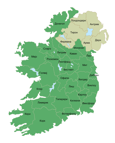
Македонски: Карта на грофовиите во Ирска. Република Ирска е зелена, а Северна Ирска е драп.
English: Map of Ireland's counties in Macedonian. |
| Date | (UTC) |
| Source |
This file was derived from: Ireland trad counties named.svg:  |
| Author |
|
| Other versions |
|


| This is a retouched picture, which means that it has been digitally altered from its original version. Modifications: Translated into Macedonian. The original can be viewed here: Ireland trad counties named.svg:
|
Licensing
[edit]
I, the copyright holder of this work, hereby publish it under the following license:
This file is licensed under the Creative Commons Attribution-Share Alike 3.0 Unported license.
- You are free:
- to share – to copy, distribute and transmit the work
- to remix – to adapt the work
- Under the following conditions:
- attribution – You must give appropriate credit, provide a link to the license, and indicate if changes were made. You may do so in any reasonable manner, but not in any way that suggests the licensor endorses you or your use.
- share alike – If you remix, transform, or build upon the material, you must distribute your contributions under the same or compatible license as the original.
Original upload log
[edit]
This image is a derivative work of the following images:
- File:Ireland_trad_counties_named.svg licensed with Cc-by-sa-3.0
- 2009-11-23T07:30:08Z Sswonk 400x500 (496002 Bytes) {{Information |Description=Map of Ireland's counties with names, Northern Ireland counties colored tan |Source=*[[:File:Population_density_of_Ireland_map2002.svg|]] |Date=2009-11-23 07:27 (UTC) |Author=*[[:File:Population_den
Uploaded with derivativeFX
File history
Click on a date/time to view the file as it appeared at that time.
| Date/Time | Thumbnail | Dimensions | User | Comment | |
|---|---|---|---|---|---|
| current | 13:42, 6 June 2012 | | 400 × 500 (451 KB) | Bjankuloski06en (talk | contribs) | Correcting transcription on one county. |
| 13:34, 6 June 2012 |  | 400 × 500 (451 KB) | Bjankuloski06en (talk | contribs) | == {{int:filedesc}} == {{Information |Description={{mk|Карта на грофовиите во Ирска. Република Ирска е зелена, а Северна Ирска е драп.}} {{en|Map of... |
You cannot overwrite this file.
File usage on Commons
The following 3 pages use this file:
File usage on other wikis
The following other wikis use this file:
- Usage on mk.wikipedia.org
- Ирска
- Покраини во Ирска
- Конахт
- Манстер
- Ленстер
- Даблин
- Алстер
- Голвеј (грофовија)
- Литрим (грофовија)
- Мејо (грофовија)
- Роскомон (грофовија)
- Слајго (грофовија)
- Клер (грофовија)
- Корк (грофовија)
- Кери
- Лимерик (грофовија)
- Типерери (грофовија)
- Вотерфорд (грофовија)
- Карлоу (грофовија)
- Килдер (грофовија)
- Даблин (грофовија)
- Килкени (грофовија)
- Лиш
- Лонгфорд (грофовија)
- Лаут (грофовија)
- Мит (грофовија)
- Офали
- Вестмит
- Вексфорд (грофовија)
- Виклоу (грофовија)
- Каван (грофовија)
- Донегол (грофовија)
- Монахан (грофовија)
- Антрим (грофовија)
- Арма (грофовија)
- Даун
- Фермана
- Лондондери (грофовија)
- Тирон
- Шаблон:Грофовии во Ирска
- Шаблон:Грофовии во Ирска-Слика
- Грофовии во Ирска
- Дан Лири-Ратдаун
- Договор за воспоставување на Устав за Европа