File:Il quartiere di Monte Mario Alto a Roma negli anni venti del Novecento.png
Jump to navigation
Jump to search
Size of this preview: 800 × 556 pixels. Other resolutions: 320 × 223 pixels | 640 × 445 pixels | 1,024 × 712 pixels | 1,280 × 890 pixels | 1,544 × 1,074 pixels.
Original file (1,544 × 1,074 pixels, file size: 4.07 MB, MIME type: image/png)
Captions
Captions
Add a one-line explanation of what this file represents
Summary[edit]
| Description |
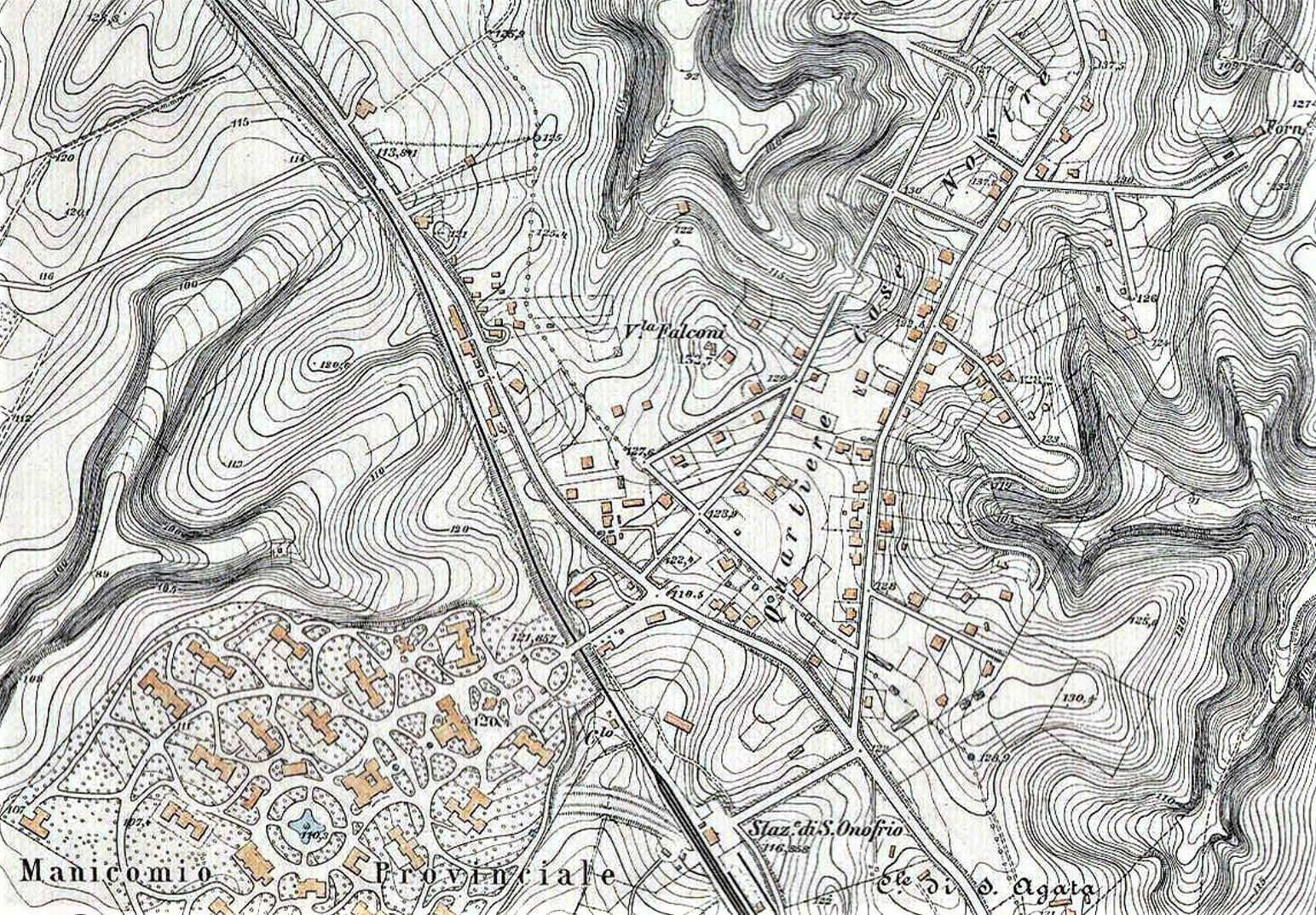
Italiano: Nella carta IGM redatta tra il 1907 ed il 1924 si individua il primo nucleo abitativo del quartiere di Monte Mario Alto a Roma, allora denominato "Case Nostre", sorto dirimpetto al manicomio provinciale di Santa Maria della Pietà e non lontano dalla stazione ferroviaria di Sant'Onofrio, in seguito ribattezzata stazione di Roma Monte Mario |
| Date | |
| Source | Piano topografico di Roma e suburbio 1907-1924 |
| Author | Istituto Geografico Militare del Regno d'Italia |
Licensing[edit]
This work is in the public domain in the United States because it was published (or registered with the U.S. Copyright Office) before January 1, 1929.
Public domain works must be out of copyright in both the United States and in the source country of the work in order to be hosted on the Commons. If the work is not a U.S. work, the file must have an additional copyright tag indicating the copyright status in the source country.
Note: This tag should not be used for sound recordings. |
File history
Click on a date/time to view the file as it appeared at that time.
| Date/Time | Thumbnail | Dimensions | User | Comment | |
|---|---|---|---|---|---|
| current | 10:13, 12 March 2021 | | 1,544 × 1,074 (4.07 MB) | Reever (talk | contribs) | Uploaded a work by Istituto Geografico Militare del Regno d'Italia from Piano topografico di Roma e suburbio 1907-1924 with UploadWizard |
You cannot overwrite this file.
File usage on Commons
There are no pages that use this file.
File usage on other wikis
The following other wikis use this file:
- Usage on it.wikipedia.org