File:Ihnc-04.jpg
Original file (787 × 775 pixels, file size: 93 KB, MIME type: image/jpeg)
Captions
Captions
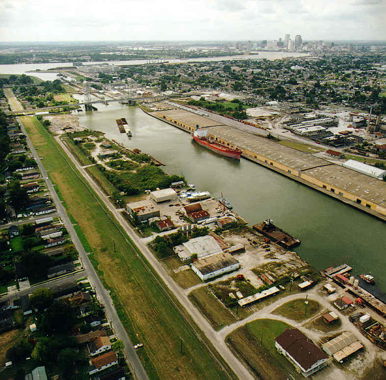
New Orleans: An aerial photograph of the Inner Harbor Navigation Canal or Industrial Canal. Vantage point is roughly Florida Avenue (not visible) in the Lower 9th Ward looking south and slightly west, with view of the Mississippi River and the skyline of the New Orleans Central Business District in the distance at top right.
Undated pre-Katrina U.S. Army Corps of Engineers photo. Upper 9th Ward/Bywater side to right; Lower 9th Ward side to left. Claiborne Avenue Bridge center left. Shows port facilities between Claiborne and Florida Avenue severely damaged or totally destroyed in Katrina. The large structure along the right side of the Canal in the foreground is the Galvez Street Wharf; Surkote Road and port facilities to left, with the Levee floodwall sepearating port from Jordan Avenue, at left, with Lower 9th Ward residential area.
Sourced from [1]
This image or file is a work of a U.S. Army Corps of Engineers soldier or employee, taken or made as part of that person's official duties. As a work of the U.S. federal government, the image is in the public domain.
|
File history
Click on a date/time to view the file as it appeared at that time.
| Date/Time | Thumbnail | Dimensions | User | Comment | |
|---|---|---|---|---|---|
| current | 13:07, 11 March 2007 | | 787 × 775 (93 KB) | Infrogmation (talk | contribs) | New Orleans: An aerial photograph of the Inner Harbor Navigation Canal or Industrial Canal. Vantage point is roughly Florida Avenue (not visible) in the Lower 9th Ward looking south and slightly west, with view of the Mississippi River and the skyline |
You cannot overwrite this file.
File usage on Commons
There are no pages that use this file.