File:IMG00032-20100920-1248.jpg - panoramio.jpg
From Wikimedia Commons, the free media repository
Jump to navigation
Jump to search
Size of this preview: 800 × 600 pixels. Other resolutions: 320 × 240 pixels | 640 × 480 pixels | 1,024 × 768 pixels | 1,280 × 960 pixels | 2,048 × 1,536 pixels.
Original file (2,048 × 1,536 pixels, file size: 485 KB, MIME type: image/jpeg)
File information
Structured data
Captions
DescriptionIMG00032-20100920-1248.jpg - panoramio.jpg |
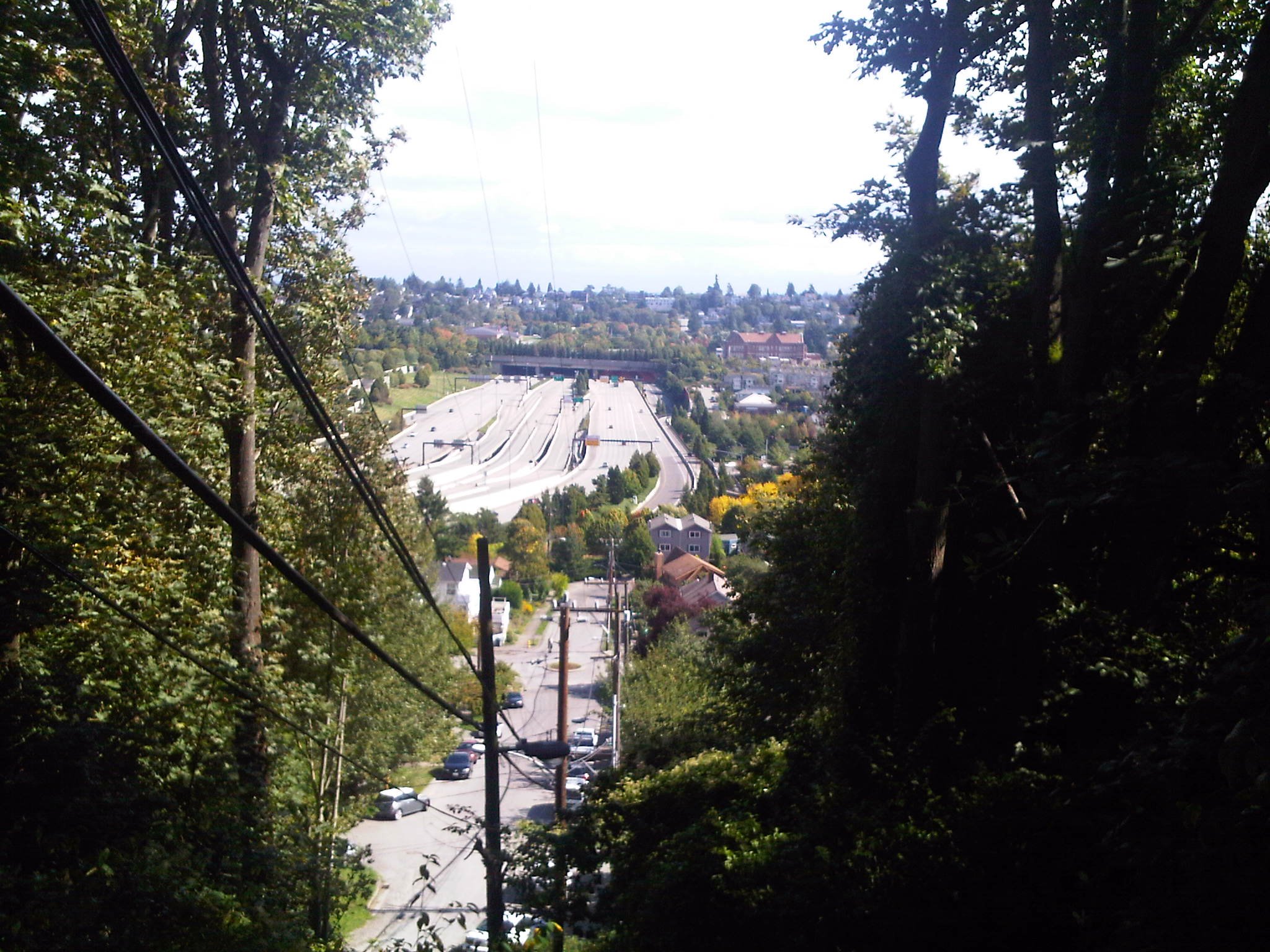
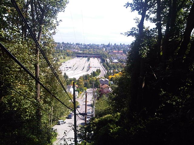
English: West portal of Mount Baker Ridge Tunnels in Interstate 90, seen across the Rainier Valley from Beacon Hill, Seattle, Washington, U.S. |
||
Date | Taken on 20 September 2010 | ||
Source | https://web.archive.org/web/20161110162403/http://www.panoramio.com/photo/41061883 | ||
Author | dwegner | ||
Permission (Reusing this file) |
This file is licensed under the Creative Commons Attribution-Share Alike 3.0 Unported license. Attribution: dwegner
|
||
Tags (from Panoramio photo page) InfoField | Seattle |
Camera location | 47° 35′ 23.64″ N, 122° 18′ 48.9″ W | View this and other nearby images on: OpenStreetMap | 47.589901; -122.313583 |
---|
Annotations InfoField | This image is annotated: View the annotations at Commons |
1152
515
172
82
2048
1536
Northwest African American Museum (former Colman School)
File history
Click on a date/time to view the file as it appeared at that time.
Date/Time | Thumbnail | Dimensions | User | Comment | |
---|---|---|---|---|---|
current | 15:45, 10 November 2016 | 2,048 × 1,536 (485 KB) | Panoramio upload bot (talk | contribs) | {{Information |description=IMG00032-20100920-1248.jpg |date={{Taken on|2010-09-20}} |source=http://www.panoramio.com/photo/41061883 |author=[http://www.panoramio.com/user/553054?with_photo_id=41061883 dwegner] |permission={{cc-by-sa-3.0|dwegner}} {{Pan... |
You cannot overwrite this file.
File usage on Commons
There are no pages that use this file.
Metadata
This file contains additional information such as Exif metadata which may have been added by the digital camera, scanner, or software program used to create or digitize it. If the file has been modified from its original state, some details such as the timestamp may not fully reflect those of the original file. The timestamp is only as accurate as the clock in the camera, and it may be completely wrong.
Camera manufacturer | Research In Motion |
---|---|
Camera model | BlackBerry 9700 |
Exposure time | 0/1 sec (0) |
Date and time of data generation | 12:47, 20 September 2010 |
Latitude | 47° 35′ 23.64″ N |
Longitude | 122° 18′ 48.9″ W |
Altitude | 66 meters above sea level |
Horizontal resolution | 72 dpi |
Vertical resolution | 72 dpi |
Software used | picnik.com |
File change date and time | 12:47, 20 September 2010 |
Y and C positioning | Centered |
Exif version | 2.2 |
Meaning of each component |
|
Subject distance | 0 meters |
Light source | Unknown |
Flash | Flash did not fire, No flash function |
Supported Flashpix version | 1 |
Color space | sRGB |
Speed unit | Kilometers per hour |
Speed of GPS receiver | 0 |
Reference for direction of movement | True direction |
Direction of movement | 163.75 |
GPS tag version | 0.0.2.2 |
Structured data
Items portrayed in this file
depicts
20 September 2010
47°35'23.6434938"N, 122°18'48.9001464"W
image/jpeg
Hidden categories:
- United States photographs taken on 2010-09-20
- CC-BY-SA-3.0
- Panoramio images reviewed by trusted users
- Photos from Panoramio
- Files with coordinates missing SDC location of creation
- Panoramio files uploaded by Panoramio upload bot
- Images with annotations
- Taken with BlackBerry 9700
- Photos from Panoramio ID 553054
- Pages with maps