File:I66toscale.png
Jump to navigation
Jump to search
No higher resolution available.
I66toscale.png (800 × 253 pixels, file size: 36 KB, MIME type: image/png)
Captions
Captions
Add a one-line explanation of what this file represents
Summary
[edit]
| Description |
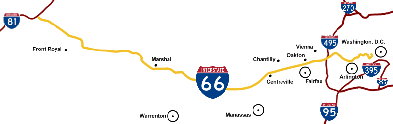
English: To scale map of Interstate 66 showing DC area interstates and cities along the Interstate 66 corridor. |
| Date | |
| Source | Own work |
| Author | Squiggyfm |
| Permission (Reusing this file) |
I grant anyone the right to use this work for any purpose, without any conditions, unless such conditions are required by law. |
Licensing
[edit]
| I, the copyright holder of this work, release this work into the public domain. This applies worldwide. In some countries this may not be legally possible; if so: I grant anyone the right to use this work for any purpose, without any conditions, unless such conditions are required by law. |
File history
Click on a date/time to view the file as it appeared at that time.
| Date/Time | Thumbnail | Dimensions | User | Comment | |
|---|---|---|---|---|---|
| current | 21:57, 20 January 2009 | 800 × 253 (36 KB) | Squiggyfm (talk | contribs) | {{Information |Description={{en|1=To scale map of Interstate 66 showing DC area interstates and cities along the Interstate 66 corridor. }} |Source=Own work by uploader |Author=Squiggyfm |Date=January 20, 2009 |Permission=I grant anyon |
You cannot overwrite this file.
File usage on Commons
The following page uses this file:
File usage on other wikis
The following other wikis use this file:
- Usage on en.wikipedia.org
- Usage on es.wikipedia.org