File:Historische Karte CH 1416.png
Jump to navigation
Jump to search
Size of this preview: 800 × 486 pixels. Other resolutions: 320 × 194 pixels | 640 × 389 pixels | 1,024 × 622 pixels | 1,280 × 777 pixels | 2,820 × 1,712 pixels.
Original file (2,820 × 1,712 pixels, file size: 738 KB, MIME type: image/png)
Captions
Captions
Add a one-line explanation of what this file represents
| Description |
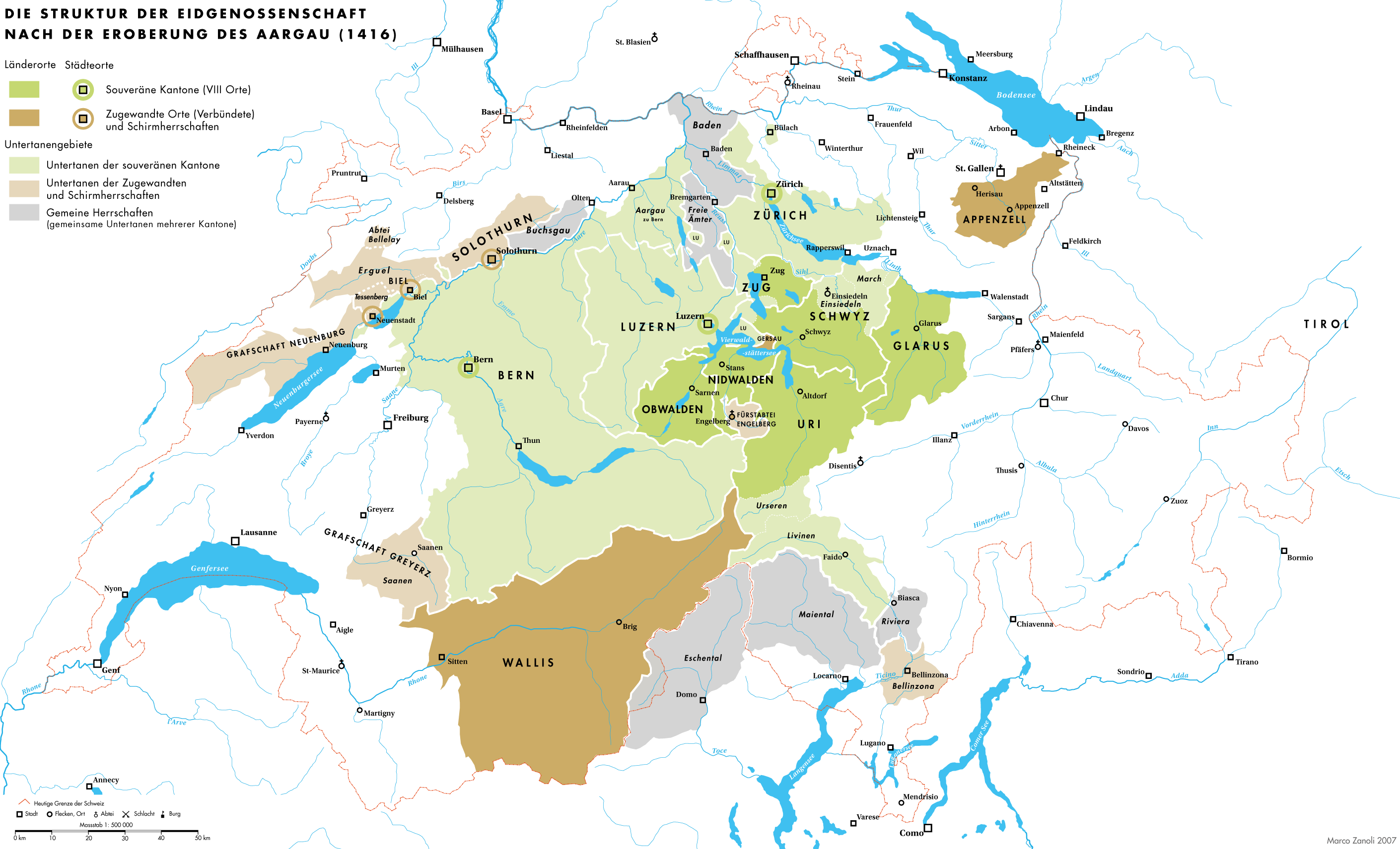
Deutsch: Die Struktur der Eidgenossenschaft der Acht Orte nach der Eroberung des Aargau 1416 |
| Date | |
| Source | Own work |
| Author | Marco Zanoli (Sidonius) |
| Other versions |
|


You may use my work outside wikipedia for free as long as you name me as the author. If you would like to use my work in a print medium, please send me a specimen copy.
Contact me if you have questions regarding the license or if you want individual changes to the map (marco.zanoli at hotmail.ch). This file is licensed under the Creative Commons Attribution-Share Alike 4.0 International license. Attribution: Marco Zanoli
|
File history
Click on a date/time to view the file as it appeared at that time.
| Date/Time | Thumbnail | Dimensions | User | Comment | |
|---|---|---|---|---|---|
| current | 18:21, 21 October 2012 | | 2,820 × 1,712 (738 KB) | Sidonius (talk | contribs) | -Inhaltliche Fehler behoben (falsche Einfärbung Gemeine Herrschaften Eschental und Maiental) -PNG-Fehler behoben durch Erhöhung der Auflösung -Schweizer Grenze durchgehend |
| 04:42, 4 July 2010 |  | 2,500 × 1,518 (762 KB) | DcoetzeeBot (talk | contribs) | Remove watermark, add author and license data to image metadata, decrease filesize with pngcrush | |
| 22:16, 13 December 2007 |  | 2,500 × 1,518 (943 KB) | Sidonius (talk | contribs) | {{Information |Description={{de|Die Struktur der Eidgenossenschaft der Acht Orte nach der Eroberung des Aargau 1416}} |Source=self-made |Date=13.12.2007 |Author= Marco Zanoli Sidonius |Permission= |other_versions= }} {{Attribution sidon |
You cannot overwrite this file.
File usage on Commons
The following 7 pages use this file:
File usage on other wikis
The following other wikis use this file:
- Usage on de.wikipedia.org
- Usage on en.wikipedia.org
- Usage on ko.wikipedia.org
- Usage on sl.wikipedia.org