File:Hispaniola and Turks and Caicos (MODIS 2018-06-18).jpg
Jump to navigation
Jump to search

Size of this preview: 644 × 600 pixels. Other resolutions: 258 × 240 pixels | 516 × 480 pixels | 825 × 768 pixels | 1,100 × 1,024 pixels | 2,100 × 1,955 pixels.
Original file (2,100 × 1,955 pixels, file size: 481 KB, MIME type: image/jpeg)
Captions
Captions
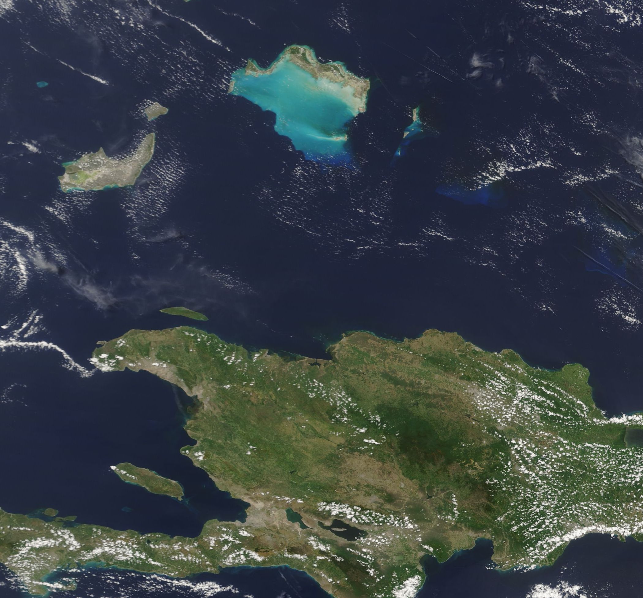
On June 15, 2018, the Moderate Resolution Imaging Spectroradiometer (MODIS) aboard NASA’s Terra satellite acquired a true-color image of part of the Turks and Caicos Islands along with a portion of Hispaniola.
Summary[edit]
.jpg&action=edit§ion=1)
| Description |
English: In the blue waters of the North Atlantic Ocean, north of the large island of Hispaniola, lies a cluster of jewel-like islands. Known as the Turks and Caicos Islands, the group contains more than 40 islands and cays and draw more than a million tourists each year – even though only five of the larger islands and a few of the smaller islands are inhabited. Each of the low-lying islands sit atop undersea pillars of coral and many are surrounded by spectacular coral reefs.
On June 15, 2018, the Moderate Resolution Imaging Spectroradiometer (MODIS) aboard NASA’s Terra satellite acquired a true-color image of part of the Turks and Caicos Islands along with a portion of Hispaniola. Bright peacock blue marks a lagoon-like reef system around islands in the Caicos group including, from west to east, Providenciales, North Caicos, Grand Caicos and East Caicos. Further east, brilliant blue also rings Grand Turk Island and the smaller Salt Cay (in the south). In the west the largest island is Inagua Islands and the smaller one in the north is Little Inagua – both part of the Bahamas. Hispaniola lies in the south. The west of this large island belongs to Haiti and the eastern section belongs to the Dominican Republic. |
||
| Date | Taken on 15 June 2018 | ||
| Source |
Hispaniola and Turks and Caicos (direct link)
|
||
| Author | Jeff Schmaltz, MODIS Land Rapid Response Team, NASA GSFC |
| This media is a product of the Terra mission Credit and attribution belongs to the mission team, if not already specified in the "author" row |
Licensing[edit]
.jpg&action=edit§ion=2)
| This file is in the public domain in the United States because it was solely created by NASA. NASA copyright policy states that "NASA material is not protected by copyright unless noted". (See Template:PD-USGov, NASA copyright policy page or JPL Image Use Policy.) | ||
 |
Warnings:
|
File history
Click on a date/time to view the file as it appeared at that time.
| Date/Time | Thumbnail | Dimensions | User | Comment | |
|---|---|---|---|---|---|
| current | 01:41, 17 February 2024 | | 2,100 × 1,955 (481 KB) | OptimusPrimeBot (talk | contribs) | #Spacemedia - Upload of http://modis.gsfc.nasa.gov/gallery/images/image06182018_250m.jpg via Commons:Spacemedia |
You cannot overwrite this file.
File usage on Commons
There are no pages that use this file.
.jpg&oldid=852821158)