File:Hinton West Virginia.jpg
Jump to navigation
Jump to search

Size of this preview: 800 × 497 pixels. Other resolutions: 320 × 199 pixels | 640 × 397 pixels | 1,024 × 636 pixels | 1,280 × 795 pixels | 2,812 × 1,746 pixels.
Original file (2,812 × 1,746 pixels, file size: 3.41 MB, MIME type: image/jpeg)
Captions
Captions
Add a one-line explanation of what this file represents
|
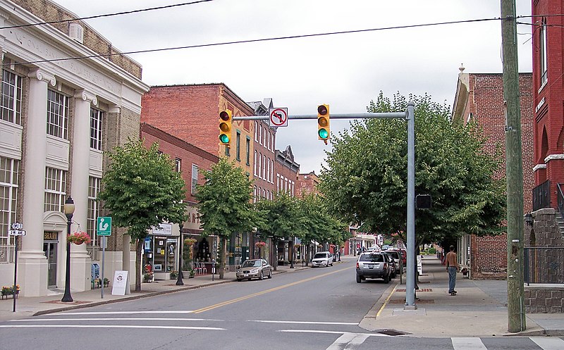
This is an image of a place or building that is listed on the National Register of Historic Places in the United States of America. Its reference number is 84003670. |
| Description | Temple Street (West Virginia Route 20) as viewed from 2nd Avenue in w:Hinton, West Virginia |
| Date | |
| Source | Own work |
| Author | Tim Kiser (w:User:Malepheasant) |
| Permission (Reusing this file) |
I publish this photograph according to the terms of the Creative Commons Share-Alike Attribution-Required License 3.0, U.S. |
| Object location | | View this and other nearby images on: OpenStreetMap |
|---|
This file is licensed under the Creative Commons Attribution-Share Alike 3.0 United States license.
- You are free:
- to share – to copy, distribute and transmit the work
- to remix – to adapt the work
- Under the following conditions:
- attribution – You must give appropriate credit, provide a link to the license, and indicate if changes were made. You may do so in any reasonable manner, but not in any way that suggests the licensor endorses you or your use.
- share alike – If you remix, transform, or build upon the material, you must distribute your contributions under the same or compatible license as the original.

File history
Click on a date/time to view the file as it appeared at that time.
| Date/Time | Thumbnail | Dimensions | User | Comment | |
|---|---|---|---|---|---|
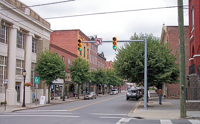
| current | 08:09, 20 November 2007 | | 2,812 × 1,746 (3.41 MB) | TimK MSI (talk | contribs) | {{Information |Description= Temple Street (West Virginia Route 20) in w:Hinton, West Virginia |Source= self-made |Date= 2007-07-05 |Author= Tim Kiser (w:User:Malepheasant) |Permission= I publish this photograph accordi |
You cannot overwrite this file.
File usage on Commons
The following 2 pages use this file:
File usage on other wikis
The following other wikis use this file:
- Usage on ar.wikipedia.org
- Usage on arz.wikipedia.org
- Usage on azb.wikipedia.org
- Usage on ca.wikipedia.org
- Usage on ceb.wikipedia.org
- Usage on ce.wikipedia.org
- Usage on cy.wikipedia.org
- Usage on dag.wikipedia.org
- Usage on en.wikipedia.org
- Usage on en.wikivoyage.org
- Usage on es.wikipedia.org
- Usage on eu.wikipedia.org
- Usage on fa.wikipedia.org
- Usage on fr.wikipedia.org
- Usage on hu.wikipedia.org
- Usage on hy.wikipedia.org
- Usage on it.wikipedia.org
- Usage on kw.wikipedia.org
- Usage on lld.wikipedia.org
- Usage on pl.wikipedia.org
- Usage on pt.wikipedia.org
- Usage on ru.wikipedia.org
- Usage on sh.wikipedia.org
- Usage on sr.wikipedia.org
- Usage on sv.wikipedia.org
- Usage on tt.wikipedia.org
- Usage on uk.wikipedia.org
- Usage on ur.wikipedia.org
- Usage on www.wikidata.org
Metadata
Categories:
- Hinton Historic District
- Sidewalks in West Virginia
- Streets in West Virginia
- Historic districts on the National Register of Historic Places in West Virginia
- National Register of Historic Places in Summers County, West Virginia
- West Virginia Route 20
- Roads in Summers County, West Virginia
- July in Summers County, West Virginia