File:Hikers in SInai Desert valley.jpg
Jump to navigation
Jump to search

Size of this preview: 800 × 235 pixels. Other resolutions: 320 × 94 pixels | 640 × 188 pixels | 1,024 × 301 pixels | 1,280 × 376 pixels | 4,347 × 1,276 pixels.
Original file (4,347 × 1,276 pixels, file size: 839 KB, MIME type: image/jpeg)
Captions
Captions
Add a one-line explanation of what this file represents
Summary[edit]
| Camera location | | View this and other nearby images on: OpenStreetMap |
|---|
| Description |
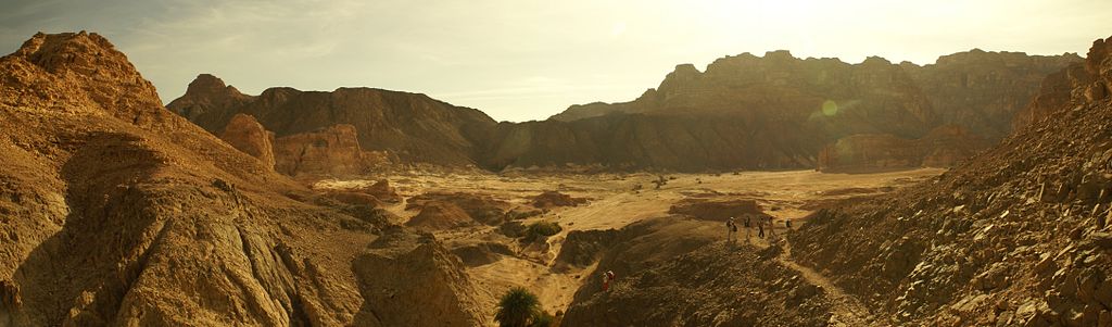
English: A panoramic image of a plateau in the Sinai Desert, Egypt. A group of hikers can be seen in the right part of the photo. Later in the same day, this group would chose a location on this plateau as overnight camp. The spot is behind the large wall of rock on the farther side of the plateau.
Deutsch: Panoramafoto eines Plateaus in der Wüste Sinai, Ägypten. Ein Gruppe Wanderer ist im rechten Teil des Photos zu sehen. Später am selben Tag wählte diese Gruppe einen Platz auf diesem Plateau als Übernacht-Lagerplatz. Dieser Platz befand sich hinter der Felswand, die auf dem Photo auf der rechten Seite des Plateaus sichtbar ist. |
| Date | |
| Source | Own work |
| Author | Florian Prischl |
| This work was created by Florian Prischl
Please credit this : Florian Prischl/Wikimedia Commons If you use this image outside a Wikimedia project, I would appreciate if you You can find more works in my user gallery. |
Licensing[edit]
I, the copyright holder of this work, hereby publish it under the following licenses:
This file is licensed under the Creative Commons Attribution-Share Alike 3.0 Unported license.
- You are free:
- to share – to copy, distribute and transmit the work
- to remix – to adapt the work
- Under the following conditions:
- attribution – You must give appropriate credit, provide a link to the license, and indicate if changes were made. You may do so in any reasonable manner, but not in any way that suggests the licensor endorses you or your use.
- share alike – If you remix, transform, or build upon the material, you must distribute your contributions under the same or compatible license as the original.

|
Permission is granted to copy, distribute and/or modify this document under the terms of the GNU Free Documentation License, Version 1.2 or any later version published by the Free Software Foundation; with no Invariant Sections, no Front-Cover Texts, and no Back-Cover Texts. A copy of the license is included in the section entitled GNU Free Documentation License. |
You may select the license of your choice.
File history
Click on a date/time to view the file as it appeared at that time.
| Date/Time | Thumbnail | Dimensions | User | Comment | |
|---|---|---|---|---|---|
| current | 16:51, 9 December 2008 | 4,347 × 1,276 (839 KB) | Florian Prischl (talk | contribs) | {{Information |Description={{en|1=A panoramic image of a plateau in the Sinai Desert, Egypt. A group of hikers can be seen in the right part of the photo. Later in the same day, this group would chose a location on this plateau as |
You cannot overwrite this file.
File usage on Commons
The following 3 pages use this file:
File usage on other wikis
The following other wikis use this file:
- Usage on pl.wikipedia.org