File:Heron UAV operators.PNG
Jump to navigation
Jump to search

Size of this preview: 800 × 407 pixels. Other resolutions: 320 × 163 pixels | 640 × 325 pixels | 1,024 × 521 pixels | 1,280 × 651 pixels | 2,753 × 1,400 pixels.
Original file (2,753 × 1,400 pixels, file size: 91 KB, MIME type: image/png)
Captions
Captions
Add a one-line explanation of what this file represents
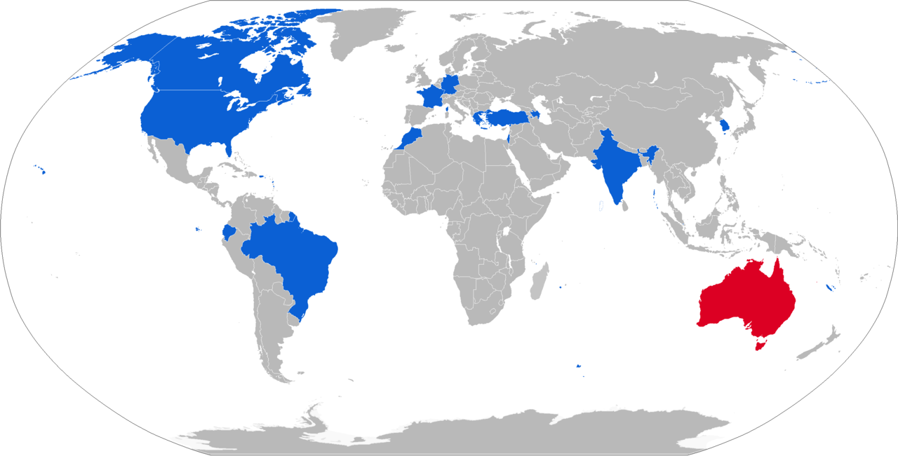
| Description | Map with military IAI Heron UAV operators in blue, with former operators in red and law enforcement operators in light blue | ||
| Date | |||
| Source | Own work, derivative of File:BlankMap-World-v8.png | ||
| Author | Natan Flayer | ||
| Permission (Reusing this file) |
|

| This is a retouched picture, which means that it has been digitally altered from its original version. Modifications: Heron UAV operators colored in blue. The original can be viewed here: BlankMap-World.png:
|
| I, the copyright holder of this work, release this work into the public domain. This applies worldwide. In some countries this may not be legally possible; if so: I grant anyone the right to use this work for any purpose, without any conditions, unless such conditions are required by law. |
Original upload log[edit]
This image is a derivative work of the following images:
- File:BlankMap-World.png licensed with PD-user
- 2010-02-01T03:10:44Z R-41 1425x625 (31271 Bytes) Since Kosovo is shown as a disputed territory due to it being partially recognized, I have added other partially recognized territories.
File history
Click on a date/time to view the file as it appeared at that time.
| Date/Time | Thumbnail | Dimensions | User | Comment | |
|---|---|---|---|---|---|
| current | 14:24, 15 January 2019 | | 2,753 × 1,400 (91 KB) | Jurryaany (talk | contribs) | Brazilian Air Force now also operating |
| 14:14, 7 February 2018 |  | 2,753 × 1,400 (91 KB) | Jurryaany (talk | contribs) | Added Greece | |
| 15:45, 9 August 2017 |  | 2,753 × 1,400 (91 KB) | Jurryaany (talk | contribs) | Updated map, moved it to new style. I'll edit the description on both the article and Wikimedia to reflect changes | |
| 16:53, 11 December 2011 |  | 1,425 × 625 (55 KB) | NatanFlayer (talk | contribs) | 12-2011 | |
| 12:52, 10 February 2010 |  | 1,425 × 625 (50 KB) | NatanFlayer (talk | contribs) | {{Information |Description=A blank map of the world as of 2008, with country outlines, for making country locator maps. This map uses the Robinson projection centered on the Greenwich Prime Meridian and includes various [[:en: |
You cannot overwrite this file.
File usage on Commons
The following 8 pages use this file:
- User:Geagea/Culture of Israel/2019 January 15
- User:Geagea/Israel/2017 August 9
- User:Geagea/Israel/2018 February 7
- User:Geagea/Politics of Israel/2019 January 15
- User:Geagea/Society of Israel/2019 January 15
- Commons:WikiProject Aviation/recent uploads/2017 August 9
- Commons:WikiProject Aviation/recent uploads/2018 February 7
- Commons:WikiProject Aviation/recent uploads/2019 January 15
File usage on other wikis
The following other wikis use this file:
- Usage on cs.wikipedia.org
- Usage on de.wikipedia.org
- Usage on es.wikipedia.org
- Usage on it.wikipedia.org
- Usage on ja.wikipedia.org
- Usage on ko.wikipedia.org
- Usage on ru.wikipedia.org
- Usage on sr.wikipedia.org