File:Hawaii hurricane tracks.png
Jump to navigation
Jump to search
Size of this preview: 800 × 400 pixels. Other resolutions: 320 × 160 pixels | 640 × 320 pixels | 1,024 × 512 pixels | 2,000 × 1,000 pixels.
Original file (2,000 × 1,000 pixels, file size: 293 KB, MIME type: image/png)
Captions
Captions
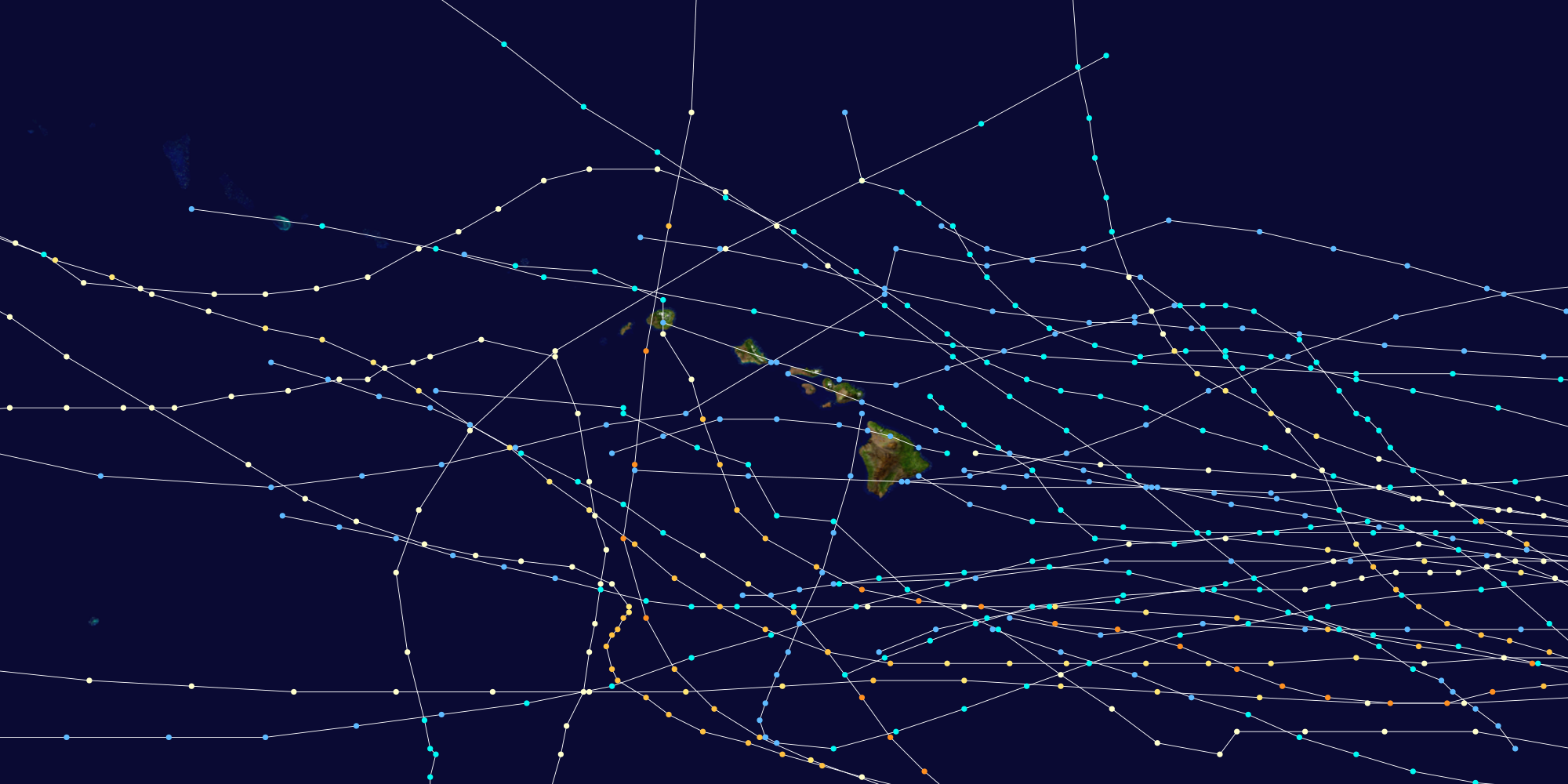
The pattern evidences only 1 in 4 storms or hurricanes come near the Islands.
Summary[edit]
This map shows the tracks of all Tropical cyclones with effects in Hawaii. Uses the color scheme from the Saffir-Simpson Hurricane Scale.
Licensing[edit]
Created using User:jdorje/Tracks. Background image from Image:Whole_world_-_land_and_oceans.jpg (NASA). Tracking data from the w:National Hurricane Center. [1] archive copy at the Wayback Machine
| I, the copyright holder of this work, release this work into the public domain. This applies worldwide. In some countries this may not be legally possible; if so: I grant anyone the right to use this work for any purpose, without any conditions, unless such conditions are required by law. |
File history
Click on a date/time to view the file as it appeared at that time.
| Date/Time | Thumbnail | Dimensions | User | Comment | |
|---|---|---|---|---|---|
| current | 15:17, 12 August 2006 | | 2,000 × 1,000 (293 KB) | Nilfanion (talk | contribs) | == Summary == This map shows the tracks of all {{w|Tropical cyclones}} with effects in {{w|Hawaii}}. Uses the color scheme from the {{w|Saffir-Simpson Hurricane Scale}}. == Licensing == Created using {{w|User:jdorje/Tracks}}. Background image from [[:Im |
You cannot overwrite this file.
File usage on Commons
The following page uses this file:
File usage on other wikis
The following other wikis use this file:
- Usage on en.wikipedia.org