File:Hart Bank on a misty morning (geograph 6401181).jpg
Jump to navigation
Jump to search

Size of this preview: 800 × 524 pixels. Other resolutions: 320 × 210 pixels | 640 × 420 pixels | 1,024 × 671 pixels | 1,280 × 839 pixels.
Original file (1,280 × 839 pixels, file size: 171 KB, MIME type: image/jpeg)
Captions
Captions
Add a one-line explanation of what this file represents
Summary[edit]
.jpg&action=edit§ion=1)
| Description |
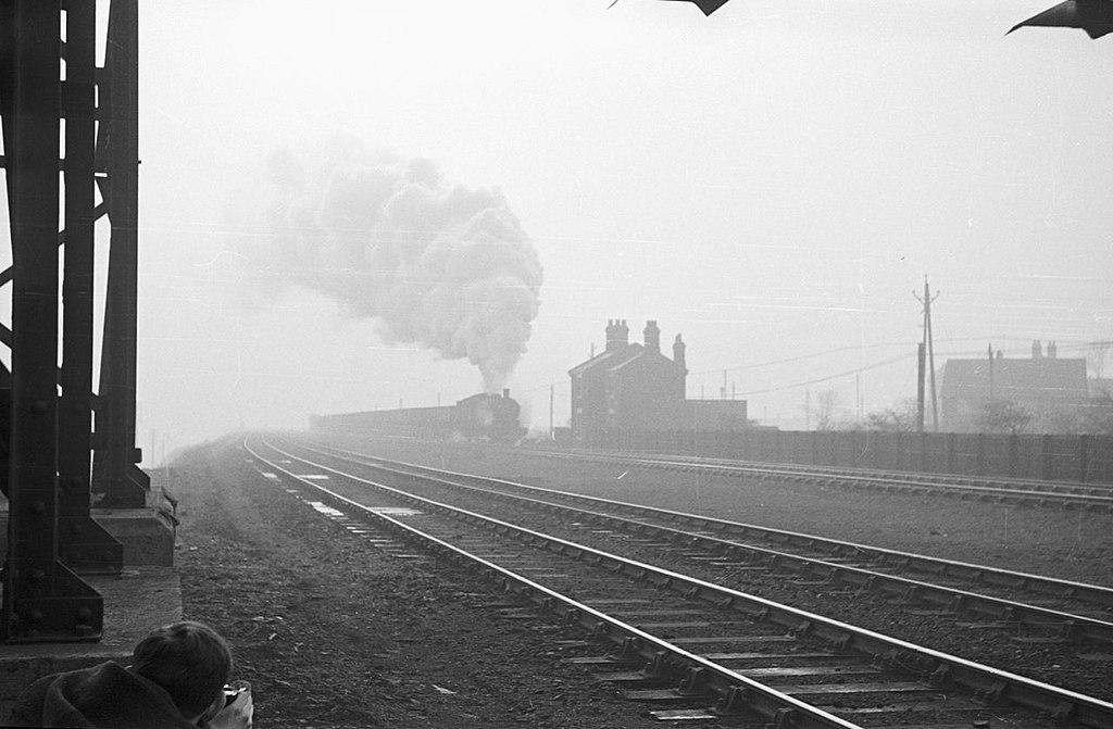
English: Former LNER Q6 63410 pounds up Hart Bank from Hartlepool with a rake of empty coal wagons on a misty morning. The nearest pair of rails is still in use, but those that the train is on have been replaced by the Hart to Haswell Walkway. |
| Date | |
| Source | From geograph.org.uk |
| Author | Alan Murray-Rust |
| Permission (Reusing this file) |
Creative Commons Attribution Share-alike license 2.0 |
| Attribution (required by the license) | Alan Murray-Rust / Hart Bank on a misty morning / |
| Camera location | | View this and other nearby images on: OpenStreetMap |
|---|
.jpg¶ms=054.719204_N_-001.250928_E_globe:Earth_type:camera_source:geograph-osgb36(NZ48353628)_heading:135.00&language=en)
| Object location | | View this and other nearby images on: OpenStreetMap |
|---|
.jpg¶ms=054.718840_N_-001.250310_E_globe:Earth_class:object_type:object_source:geograph-osgb36(NZ48393624)_heading:135.00&language=en)
Licensing[edit]
.jpg&action=edit§ion=2)

|
This image was taken from the Geograph project collection. See this photograph's page on the Geograph website for the photographer's contact details. The copyright on this image is owned by Alan Murray-Rust and is licensed for reuse under the Creative Commons Attribution-ShareAlike 2.0 license.
|
This file is licensed under the Creative Commons Attribution-Share Alike 2.0 Generic license.
Attribution: Alan Murray-Rust
- You are free:
- to share – to copy, distribute and transmit the work
- to remix – to adapt the work
- Under the following conditions:
- attribution – You must give appropriate credit, provide a link to the license, and indicate if changes were made. You may do so in any reasonable manner, but not in any way that suggests the licensor endorses you or your use.
- share alike – If you remix, transform, or build upon the material, you must distribute your contributions under the same or compatible license as the original.
File history
Click on a date/time to view the file as it appeared at that time.
| Date/Time | Thumbnail | Dimensions | User | Comment | |
|---|---|---|---|---|---|
| current | 23:10, 8 February 2021 | | 1,280 × 839 (171 KB) | User.who.is.anonymous (talk | contribs) | Transferred from geograph.co.uk using [https://tools.wmflabs.org/geograph2commons/ geograph2commons] |
You cannot overwrite this file.
File usage on Commons
The following page uses this file:
File usage on other wikis
The following other wikis use this file:
- Usage on en.wikipedia.org
.jpg&oldid=722278813)